Toggle navigation
LMEC Home
Exhibitions
Georeferencing
Tools for Teachers
Collections
My Favorites
Sign Up / Log In
Search
Search the map portal
Map Collection
Map Collection
Map Sets
Search
Search
Search for
Search In
All Fields
Creator
Title
Subject
Place
Search All Digital Collections
Advanced Search
9020 Results
My Search
Start Over
More Like
commonwealth:tq57t2387
Remove constraint More Like: commonwealth:tq57t2387
Filter your Search
Place
North and Central America
6,247
United States
5,129
Massachusetts
2,095
Europe
1,396
Suffolk (county)
1,066
Boston
1,034
Canada
463
Asia
438
more
Place
»
Topic
Boston (Mass.)--Maps
594
United States--History--Revolution, 1775-1783--Maps
330
United States--Maps
283
Real property--Massachusetts--Boston--Maps
175
Massachusetts--Maps
163
Landowners--Massachusetts--Boston--Maps
133
New England--Maps
103
North America--Maps--Early works to 1800
103
more
Topic
»
Date
Date range begin
–
Date range end
Current results range from
1482
to
2023
View distribution
Creator
United States. Hydrographic Office
595
O.H. Bailey & Co
148
Des Barres, Joseph F. W. (Joseph Frederick Wallet), 1722-1824
124
United States. Post Office Dept
120
Ptolemy, 2nd cent
100
Walling, Henry Francis, 1825-1888
94
Jefferys, Thomas, -1771
87
Geological Survey (U.S.)
86
more
Creator
»
Format
Maps/Atlases
8,955
Manuscripts
219
Prints
56
Books
36
Drawings/Illustrations
13
Objects/Artifacts
10
Posters
5
Georeferenced
Yes
871
No
8,149
Collection
Norman B. Leventhal Map & Education Center Collection
8,695
Boston and New England Maps
2,233
Urban Maps
2,023
Maritime Charts and Atlases
1,083
American Revolutionary War-Era Maps
942
William L. Clements Library Collection
305
Boston Redevelopment Authority Collection
87
American Antiquarian Society Collection
7
more
Collection
»
Available to use
No known restrictions
8,555
Creative Commons license
52
Search Constraints
Sort by relevance
relevance
title
date (asc)
date (desc)
Number of results to display per page
20 per page
10
per page
20
per page
50
per page
100
per page
View results as:
grid view
map view
Search Results
7961.
State of Arkansas
7962.
State of California
7963.
State of Chiapas
7964.
State of Colorado
7965.
State of Colorado
7966.
The State of Florida : compiled in the Bureau of Topographical Engineers from the best authorities
7967.
State of Florida
7968.
State of Florida
7969.
State of Idaho
7970.
State of Illinois
7971.
State of Illinois
7972.
State of Illinois
7973.
State of Illinois coal fields and producing districts
7974.
State of Indiana
7975.
State of Indiana
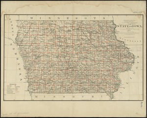
7976.
State of Indiana coal fields and producing districts
7977.
State of Iowa
7978.
State of Iowa
7979.
State of Kansas
7980.
State of Kansas
‹ Prev
Next ›
1
2
…
395
396
397
398
399
400
401
402
403
…
450
451