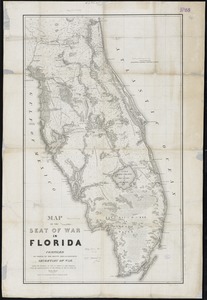
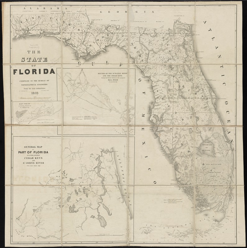
The State of Florida : compiled in the Bureau of Topographical Engineers from the best authorities
Item Information
- Title:
- The State of Florida : compiled in the Bureau of Topographical Engineers from the best authorities
- Creator:
- Bruff, Joseph Goldsborough, 1804-1889
- Name on Item:
-
by J. Goldsborough Bruff ; D. McClelland sc.
- Date:
-
1846
- Format:
-
Maps/Atlases
- Location:
-
Boston Public Library
Norman B. Leventhal Map & Education Center - Collection (local):
-
Norman B. Leventhal Map & Education Center Collection
- Subjects:
-
Indians of North America--Florida--Maps
Seminole War, 2nd, 1835-1842--Maps
Florida--Maps
- Places:
-
Florida
- Extent:
- 1 map ; 107 x 102 cm.
- Terms of Use:
-
No known copyright restrictions.
No known restrictions on use.
- Publisher:
-
Washington? :
[Bureau of Topographical Engineers]
- Scale:
-
Scale [ca. 1:726,000]
- Language:
-
English
- Notes:
-
From U.S. Senate Executive Document v.2 No. 2-5, in 30th Cong., 1st Sess., 1847-48, serial set #504.
Shows counties, forts, towns, land parcels, battle sites, physical features, etc.
Some place names also given in the indigenous language.
Insets: Key West as surveyed February 1829 by Wm. A. Whitehead Esq'r -- Mouths of the Suwanee River and the Cedar Keys -- General map of part of Florida included between Cedar Keys and St. John's River from Lieut. Blake's map.
- Identifier:
-
06_01_010949
- Call #:
-
G3930 1846 .B78
- Barcode:
-
39999065679118
- LCCN:
-
2002624052