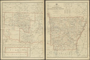
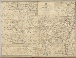
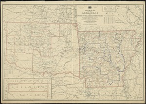
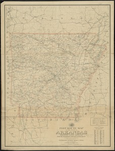
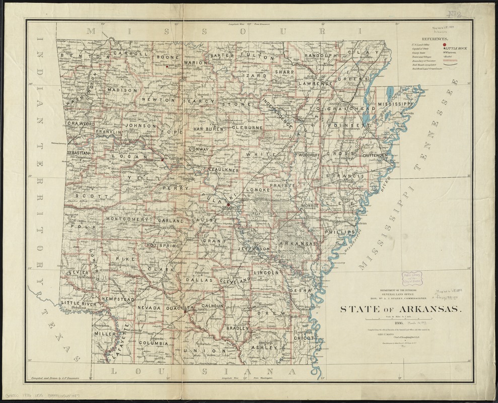
State of Arkansas
Item Information
- Title:
- State of Arkansas
- Creator:
- United States. General Land Office
- Name on Item:
-
compiled from the official records of the General Land Office and other sources by Geo U. Mayo, Chief of Draughting Div. G. L. O ; compiled and drawn by A.F. Dinsmore.
- Date:
-
1886
- Format:
-
Maps/Atlases
- Location:
-
Boston Public Library
Norman B. Leventhal Map & Education Center - Collection (local):
-
Norman B. Leventhal Map & Education Center Collection
- Subjects:
-
Counties--Arkansas--Maps
Railroads--Arkansas--Maps
Arkansas--Maps
- Places:
-
Arkansas
- Extent:
- 1 map : col. ; 68 x 85 cm.
- Terms of Use:
-
No known copyright restrictions.
No known restrictions on use.
- Publisher:
-
[Washington, D.C.] :
Dept. of the Interior, General Land Office
- Scale:
-
Scale [1:633,600]. 10 miles = 1 in.
- Language:
-
English
- Notes:
-
Prime meridians: Washington and Greenwich.
Relief shown by hachures.
- Identifier:
-
06_01_008850
- Call #:
-
G4000 1886 .U55
- Barcode:
-
39999065657387
- LCCN:
-
92684981