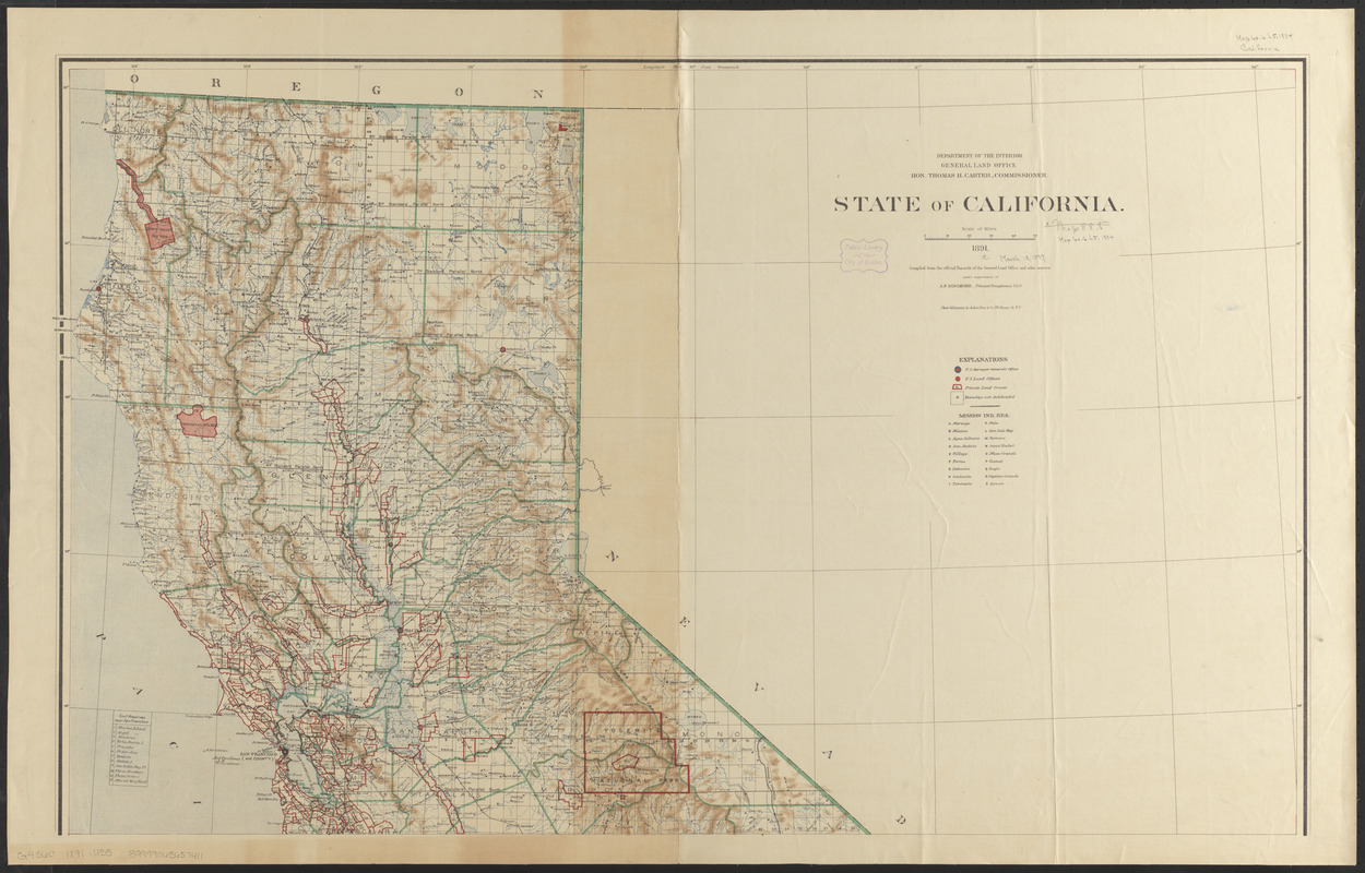
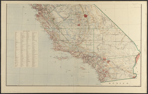
State of California

Item Information
- Title:
- State of California
- Publisher:
- United States. General Land Office
- Cartographer:
- Dinsmore, A. F. (Cartographer)
- Cartographer:
- Morton, Robert H.
- Printer:
- Bien, Julius, 1826-1909
- Name on Item:
-
compiled from the official records of the General Land Office and other sources under supervision of A.F. Dinsmore, principal draughtsman G.L.O. ; compiled and drawn by A.F. Dinsmore and R.H. Morton ; traced and lettered by Wm. Naylor
- Date:
-
1891
- Format:
-
Maps/Atlases
- Location:
-
Boston Public Library
Norman B. Leventhal Map & Education Center - Collection (local):
-
Norman B. Leventhal Map & Education Center Collection
- Subjects:
-
Land grants--California--Maps
California--Surveys
California--Maps
- Places:
-
California
- Extent:
- 1 map on 2 sheets : col. ; 123 x 99 cm., on sheets 69 x 109 cm.
- Terms of Use:
-
No known copyright restrictions.
No known restrictions on use.
- Publisher:
-
[Washington, D.C.?] :
The Office
- Scale:
-
Scale [1:900,000]
- Language:
-
English
- Notes:
-
Shows drainage, county boundaries, railroads, Indian reservations, private land grants, township and range lines, etc.
Relief shown by shading.
Prime meridians: Greenwich and Washington.
Includes lists of private land grants and gov't reserves near San Francisco.
- Identifier:
-
06_01_008853A
06_01_008853B
- Call #:
-
G4360 1891 .U55
- Barcode:
-
39999065657411


