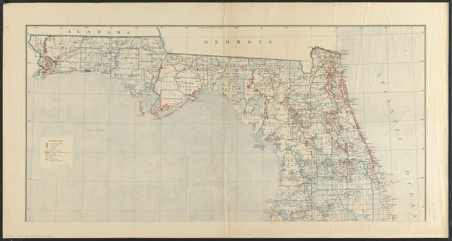
State of Florida

Item Information
- Title:
- State of Florida
- Creator:
- United States. General Land Office
- Cartographer:
- Dinsmore, A. F. (Cartographer)
- Contributor:
- Hendges, Matthew (Cartographer)
- Contributor:
- Berthrong, I. P. (Cartographer)
- Contributor:
- Mahony, F. E.
- Printer:
- Forbes Co.
- Name on Item:
-
compiled from the official records of the General Land Office and other sources under supervision of A.F. Dinsmore, principal draughtsman, G.L.O. ; drawn and compiled by A.F. Dinsmore ; traced and lettered by M. Hendges, I.P. Berthrong and F.E. Mahony
- Date:
-
1893
- Format:
-
Maps/Atlases
- Location:
-
Boston Public Library
Norman B. Leventhal Map & Education Center - Collection (local):
-
Norman B. Leventhal Map & Education Center Collection
- Subjects:
-
Florida--Maps
- Places:
-
Florida
- Extent:
- 1 map on 2 sheets : col. ; 100 x 99 cm., on sheets 59 x 112 cm.
- Terms of Use:
-
No known copyright restrictions.
No known restrictions on use.
- Publisher:
-
[Washington, D.C.] :
Dept. of the Interior, General Land Office
- Scale:
-
Scale [ca. 1:633,600]
- Language:
-
English
- Notes:
-
Shows county seats, cities and towns, completed railroads, government reservations, military installations, lighthouses, and private grants.
Prime meridians: Washington and Greenwich.
- Identifier:
-
06_01_008855B
06_01_008855A
- Call #:
-
G3930 1893 .U55
- Barcode:
-
39999065657437