Toggle navigation
LMEC Home
Exhibitions
Georeferencing
Tools for Teachers
Collections
My Favorites
Sign Up / Log In
Search
Search the map portal
Map Collection
Map Collection
Map Sets
Search
Search
Search for
Search In
All Fields
Creator
Title
Subject
Place
Search All Digital Collections
Advanced Search
9047 Results
My Search
Start Over
More Like
commonwealth:t722kt13r
Remove constraint More Like: commonwealth:t722kt13r
Filter your Search
Place
North and Central America
6,278
United States
5,196
Massachusetts
2,149
Suffolk (county)
1,398
Europe
1,396
Boston
1,371
Canada
449
Asia
438
more
Place
»
Topic
Boston (Mass.)--Maps
677
City planning--Massachusetts--Boston--Maps
418
United States--Maps
282
Urban renewal--Massachusetts--Boston--Maps
252
Real property--Massachusetts--Boston--Maps
216
Massachusetts--Maps
162
Landowners--Massachusetts--Boston--Maps
135
North America--Maps--Early works to 1800
103
more
Topic
»
Date
Date range begin
–
Date range end
Current results range from
1482
to
2023
View distribution
Creator
United States. Hydrographic Office
595
Boston Redevelopment Authority
391
O.H. Bailey & Co
148
Des Barres, Joseph F. W. (Joseph Frederick Wallet), 1722-1824
123
United States. Post Office Dept
120
Ptolemy, 2nd cent
100
Walling, Henry Francis, 1825-1888
94
Geological Survey (U.S.)
86
more
Creator
»
Format
Maps/Atlases
8,987
Manuscripts
215
Prints
56
Books
36
Objects/Artifacts
10
Drawings/Illustrations
8
Posters
5
Georeferenced
Yes
869
No
8,178
Collection
Norman B. Leventhal Map & Education Center Collection
8,694
Boston and New England Maps
2,585
Urban Maps
2,373
Maritime Charts and Atlases
1,083
American Revolutionary War-Era Maps
616
Boston Redevelopment Authority Collection
439
Available to use
No known restrictions
8,905
Creative Commons license
47
Search Constraints
Sort by relevance
relevance
title
date (asc)
date (desc)
Number of results to display per page
20 per page
10
per page
20
per page
50
per page
100
per page
View results as:
grid view
map view
Search Results
3841.
Map of Boston proper
3842.
Map of Boston proper, Charlestown, South Boston and East Boston : showing original territory of old Boston, the areas filled...
3843.
Map of Boston showing location of the Lenox
3844.
Map of Boston showing new division of wards
3845.
Map of Boston showing proposed new division of wards Oct. 1875
3846.
[Map of Boston, showing surface lines, proposed elevated lines, connecting surface lines and route of subway
3847.
[Map of Boston, showing the new wards]
3848.
Map of Boyd, Carter and Greenup Counties
3849.
Map of Bretton Woods and surroundings
3850.
Map of Bristol County Massachusetts : based on the trigonometrical survey of the state
3851.
Map of Bristol County, Rhode Island
3852.
Map of British Columbia and part of western Canada, showing the lines and lands of the Canadian Pacific Railway
3853.
Map of British Columbia to the 56th parallel, north latitude
3854.
Map of Brookline and vicinity
3855.
Map of Broome County, New York
3856.
Map of Burma : prepared for the Ireland report on colonial administration in the Far East
3857.
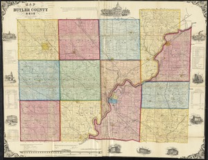
Map of Butler County, Ohio
3858.
Map of Caledonia County, Vermont
3859.
Map of Calhoun County, Michigan
3860.
Map of California and Nevada
‹ Prev
Next ›
1
2
…
189
190
191
192
193
194
195
196
197
…
452
453


![[Map of Boston, showing the new wards]](https://bpldcassets.blob.core.windows.net/derivatives/images/commonwealth:9s161h691/image_thumbnail_300.jpg)