Map of Butler County, Ohio
Item Information
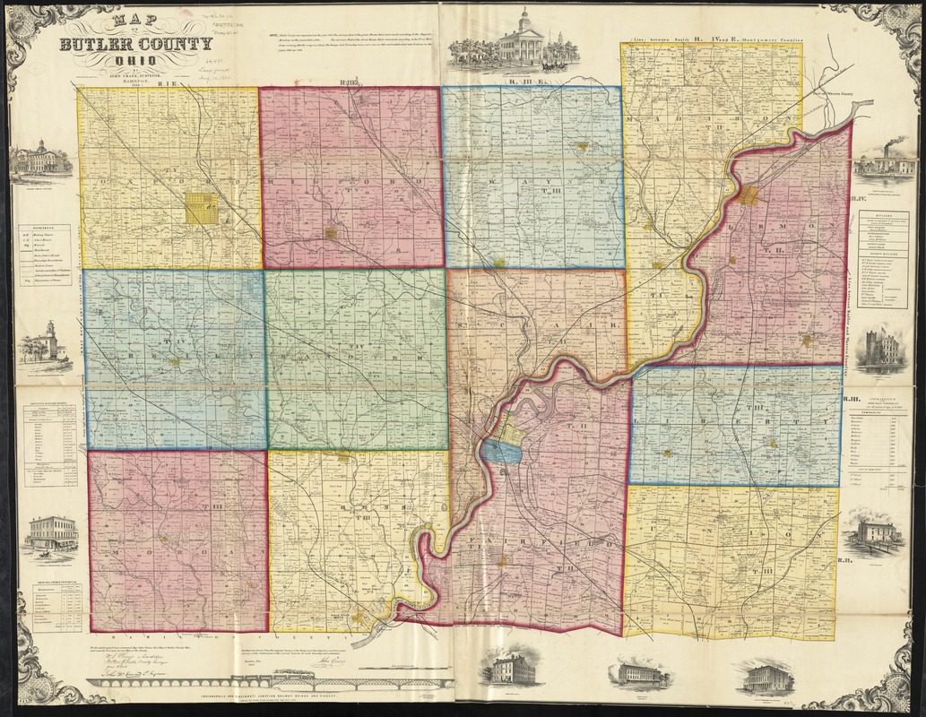
- Title:
- Map of Butler County, Ohio
- Creator:
- Crane, John, 1796-1864
- Name on Item:
-
by John Crane, surveyor.
- Date:
-
1855
- Format:
-
Maps/Atlases
- Location:
-
Boston Public Library
Norman B. Leventhal Map & Education Center - Collection (local):
-
Norman B. Leventhal Map & Education Center Collection
- Subjects:
-
Buildings--Ohio--Butler County--Pictorial works
Landowners--Ohio--Butler County--Maps
Butler County (Ohio)--Maps
- Places:
-
OhioButler (county)
- Extent:
- 1 map on 2 sheets : color, mounted on linen ; 118 x 157 cm
- Terms of Use:
-
No known copyright restrictions.
No known restrictions on use.
- Publisher:
-
Cincinnati, O. :
Middleton, Wallace & Co. Lithos.,
- Scale:
-
Scale approximately 1:31,680. 2 inches to the mile
- Language:
-
English
- Notes:
-
This map was drawn from the original surveys of the range and township lines and from recent surveys of the subdivision fo the several sections in each township and published by John Crane.
BPL copy assembled, sectioned in 4 pieces and mounted on cloth.
Includes statistical table, list of church properties, list of county officers, population list, illustration of the Indianapolis and Cincinnati Junction Railway bridge and viaduct and 10 views of public and commercial properties.
- Identifier:
-
06_01_011210
- Call #:
-
G4083.B8 1855 .C73
- Barcode:
-
39999065682526
- LCCN:
-
2012592388


