Map of Broome County, New York
Item Information
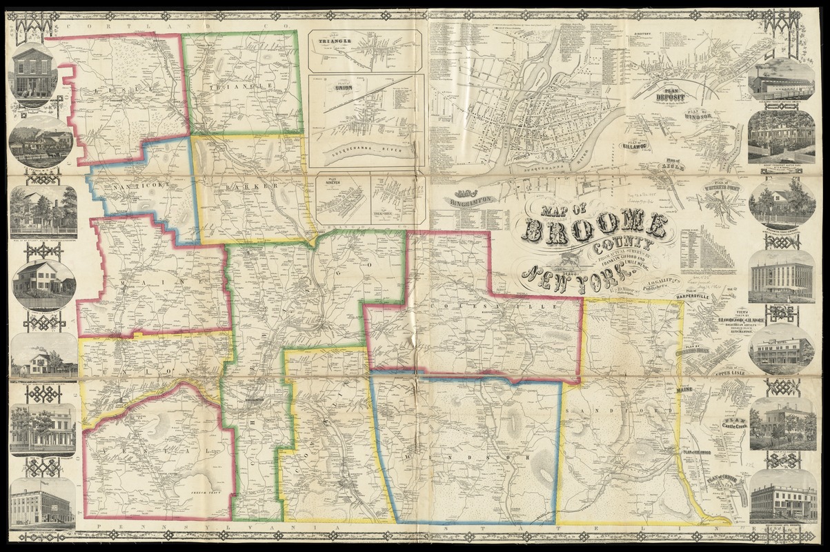
- Title:
- Map of Broome County, New York
- Creator:
- Gifford, Franklin.
- Name on Item:
-
from actual surveys by Franklin Gifford and Emile Wenig.
- Date:
-
[1855]
- Format:
-
Maps/Atlases
- Location:
-
Boston Public Library
Norman B. Leventhal Map & Education Center - Collection (local):
-
Norman B. Leventhal Map & Education Center Collection
- Subjects:
-
Landowners--New York (State)--Broome County--Maps
Cities and towns--New York (State)--Broome County--Maps
Villages--New York (State)--Broome County--Maps
Landowners--New York (State)--Binghamton--Maps
Real property--New York (State)--Binghamton--Maps
Broome County (N.Y.)--Maps
Binghamton (N.Y.)--Maps
- Places:
-
New YorkBroome (county)Binghamton
- Extent:
- 1 map : color ; 95 x 132 cm
- Terms of Use:
-
No known copyright restrictions.
No known restrictions on use.
- Publisher:
-
Philadelphia :
A.O. Gallup & Co.
- Scale:
-
Scale approximately 1:50,688
- Language:
-
English
- Notes:
-
General-content county map showing buildings in rural areas and householders' names; the Binghamton inset shows lot lines, building coverage, and some owners' names.
Relief shown by hachures.
Colored to emphasize town (township) boundaries.
"Entered according to Act of Congress in the Year 1855 by Robert Pearsall Smith in the ... Eastern District of Pennsylvania."
Includes notes, county statistical table, distance table, inset "Map of Binghamton" city, 16 village insets, local business directories, and illustrations of prominent buildings.
- Notes (date):
-
This date is inferred.
- Identifier:
-
06_01_010624
- Call #:
-
G3803.B7 1855 .G54
- Barcode:
-
39999065675207
- LCCN:
-
2013593069


