Toggle navigation
LMEC Home
Exhibitions
Georeferencing
Tools for Teachers
Collections
My Favorites
Sign Up / Log In
Search
Search the map portal
Map Collection
Map Collection
Map Sets
Search
Search
Search for
Search In
All Fields
Creator
Title
Subject
Place
Search All Digital Collections
Advanced Search
588 Results
My Search
Start Over
More Like
commonwealth:q524nd88q
Remove constraint More Like: commonwealth:q524nd88q
Filter your Search
Place
North and Central America
523
United States
384
Suffolk (county)
63
Boston
62
Massachusetts
51
New York
42
Canada
27
Boston Harbor
26
more
Place
»
Topic
Manuscript maps--Early works to 1800
138
Boston (Mass.)--Maps--Early works to 1800
46
Manuscript maps
21
Boston (Mass.)--History--Revolution, 1775-1783--Maps--Early works to 1800
18
Boston Harbor (Mass.)--Maps--Early works to 1800
18
Bunker Hill, Battle of, Boston, Mass., 1775--Maps--Early works to 1800
18
Gulf Coast (U.S.)--Maps, Manuscript--Early works to 1800
12
Fortification--New York (State)--New York--Maps--Early works to 1800
11
more
Topic
»
Date
Date range begin
–
Date range end
Current results range from
1694
to
1899
View distribution
Creator
Hills, John, (Surveyor)
18
Montrésor, John, 1736-1799
18
Dumont de Montigny
14
Bingham, William, 1752-1804
12
Adlum, John, 1759-1836
10
Faden, William, 1749-1836
10
Washington, George, 1732-1799
9
Page, Thomas Hyde, Sir, 1746-1821
8
more
Creator
»
Format
Maps/Atlases
586
Manuscripts
524
Objects/Artifacts
2
Georeferenced
Yes
13
No
575
Collection
American Revolutionary War-Era Maps
574
Library of Congress Collection
488
Boston and New England Maps
52
Norman B. Leventhal Map & Education Center Collection
52
Urban Maps
42
Newberry Library Collection
39
Maritime Charts and Atlases
36
Mapping Boston Collection
13
more
Collection
»
Available to use
Creative Commons license
507
No known restrictions
42
Search Constraints
Sort by relevance
relevance
title
date (asc)
date (desc)
Number of results to display per page
20 per page
10
per page
20
per page
50
per page
100
per page
View results as:
grid view
map view
Search Results
41.
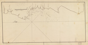
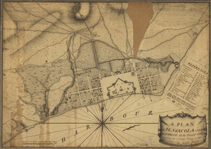
A plan of Pensacola and its environs in its present state : from an actual survey in 1778
42.
Plan of the attack on Fort William Henry and Ticonderoga : showing the road from Fort Edward, Montcalm's camp and wharf of...
43.
Plan of the city intended for the permanent seat of the government of t[he] United States : projected agreeable to the...
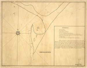
44.
A plan of the division line between the provinces of New-York and Quebec : In the 45th degree of north latitude. Survey'd in...
45.
A plan of the harbour of Cape Lookout surveyed and sounded by His Majesty's sloop Viper
46.
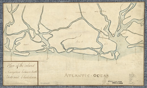
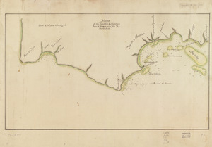
Plan of the inland navigation between South Edisto and Charlestown
47.
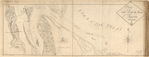
Plan of the inlet, strait, & town of St. Augustine
48.
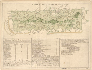
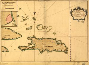
A Plan of the island of Porto Rico
49.
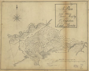
A plan of the land between Fort Mossy and St. Augustine in the province of East Florida
50.
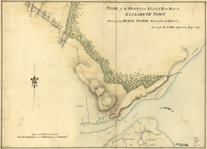
Plan of the road from Elizabeth Town Point to Elizabeth Town : shewing the rebel works raised for its defence
51.
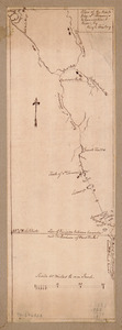
Plan of the route from St. Francis to Connecticut River
52.
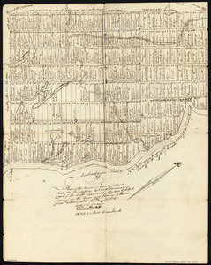
Plan of the Town of Turner, formerly Silvester Plantation : out side lines and part of the lotts ran out
53.
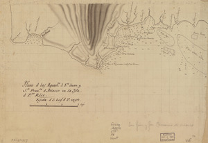
Plano d. las aguadas d. Sn. Juan y Sn. Franco. d. Añasco en la ysla de Pto. Rico, año d. 1787
54.
Plano d. las aguads. d. Sn. Juan y Sn. Franco. d. Añasco en la ysla d. Pto. Rico
55.
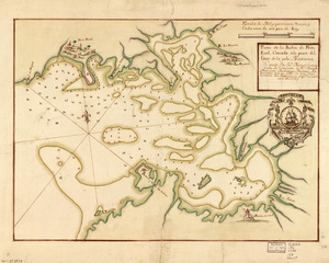
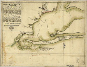
Plano de la Bahía de Fort Real cituado a la parte del oeste de la Ysla Martinica
56.
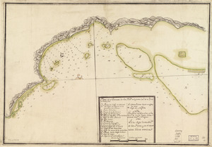
Plano de la Bahía de Ocoa situado en la banda del sur de la Ysla Española
57.
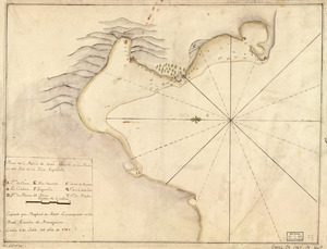
Plano de la bahia de Pansacola
58.
Plano de la enzenada de San Franco. en la parte occl. de la ysla de Puerto Rico
59.
Plano de la Ysla de Santo Domingo, parte de las Cuba, Jamaica y otras contiguas a ellas, del seno mexicano
60.
Plano de las aguadas de S. Juan y S. Franco. & Anasco en la ysla de Puerto Rico
‹ Prev
Next ›
1
2
3
4
5
6
7
…
29
30
![Plan of the city intended for the permanent seat of the government of t[he] United States](https://bpldcassets.blob.core.windows.net/derivatives/images/commonwealth:q524nf917/image_thumbnail_300.jpg)