Toggle navigation
LMEC Home
Exhibitions
Georeferencing
Tools for Teachers
Collections
My Favorites
Sign Up / Log In
Search
Search the map portal
Map Collection
Map Collection
Map Sets
Search
Search
Search for
Search In
All Fields
Creator
Title
Subject
Place
Search All Digital Collections
Advanced Search
485 Results
My Search
Start Over
More Like
commonwealth:q524nd80h
Remove constraint More Like: commonwealth:q524nd80h
Filter your Search
Place
North and Central America
421
United States
293
New York
40
Canada
21
Florida
19
Alabama
15
Chatham (county)
15
Savannah
13
more
Place
»
Topic
Manuscript maps--Early works to 1800
92
Manuscript maps
21
Gulf Coast (U.S.)--Maps, Manuscript--Early works to 1800
12
Fortification--New York (State)--New York--Maps--Early works to 1800
11
New York (N.Y.)--Buildings, structures, etc--Maps, Manuscript--Early works to 1800
9
New York (N.Y.)--Maps, Manuscript--Early works to 1800
8
Québec (Québec)--Maps, Manuscript--Early works to 1800
8
Saratoga Campaign, N.Y., 1777--Maps, Manuscript--Early works to 1800
8
more
Topic
»
Date
Date range begin
–
Date range end
Current results range from
1700
to
1899
View distribution
Creator
Hills, John, (Surveyor)
18
Montrésor, John, 1736-1799
16
Bingham, William, 1752-1804
12
Adlum, John, 1759-1836
10
Washington, George, 1732-1799
9
Faden, William, 1749-1836
7
Morgan, Benjamin, (Draftsman)
7
Wangenheim, Friedrich Adam Julius von
7
more
Creator
»
Format
Maps/Atlases
483
Manuscripts
475
Objects/Artifacts
2
Georeferenced
Yes
5
No
480
Collection
American Revolutionary War-Era Maps
485
Library of Congress Collection
480
Maritime Charts and Atlases
31
Urban Maps
15
British Library Collection
5
Available to use
Creative Commons license
485
Search Constraints
Sort by date (asc)
relevance
title
date (asc)
date (desc)
Number of results to display per page
20 per page
10
per page
20
per page
50
per page
100
per page
View results as:
grid view
map view
Search Results
61.
Braddock's route, 1755, Fort Cumberland to Fort Pitt
62.
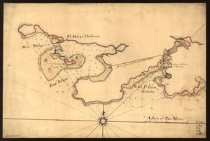
Map of St. Mary's and Petit d'Grat Harbour
63.
Map showing the Bowery Lane area of Manhattan
64.
Pansacola o Santta María de Galbe, puerto y presidio del Ry. de España situado en la costa del nortte del Seno Mexicano, los...
65.
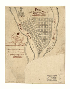
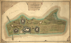
Plan and perspective view of Pittsburgh
66.
Plan of a rout undertaken in winter, Jany. 26th : from Quebec, the capital of Canada, to the frontier settlements of the...
67.
A plan of Mr. Clifton's neck land platted by a scale of 50 poles to the inch : recto
68.
A plan of Mr. Clifton's neck land platted by a scale of 50 poles to the inch : verso
69.
Plan of the inlet, strait, & town of St. Augustine
70.
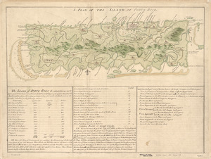
A Plan of the island of Porto Rico
71.
Plan of the Isle aux Noix, in the River Richelieu, and Province of Canada
72.
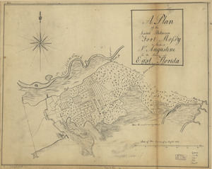
A plan of the land between Fort Mossy and St. Augustine in the province of East Florida
73.
Plano del Puerto de Cabañas situado en la costa del norte de la ysla de Cuba, 12 leguas al ote. de la Havana
74.
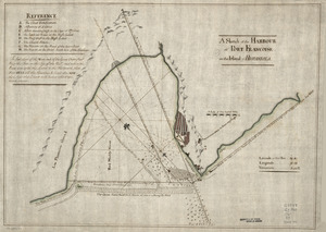
A Sketch of the harbour of Port Francoise on the Island of Hispaniola
75.
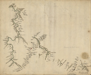
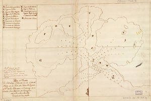
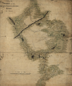
A map of the sources of the Chaudière, Penobscot, and Kennebec rivers
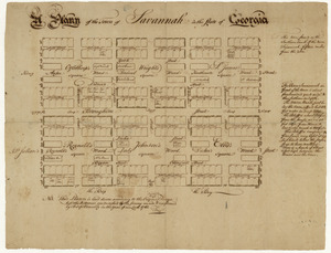
76.
A plann of the town of Savannah in the state of Georgia
77.
Plan of the siege of the Havana surrenderid [sic] Aug. 12, 1762 to the English commanded by the Earl of Albemarle General and...
78.
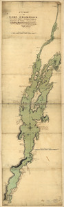
A survey of Lake Champlain, from Crown Point to Windmil Point, and from thence to St. Iohns
79.
Map of a route through south west Pennsylvania from Fort Loudon, Franklin Co. to Fort Pitt, Pittsburgh
80.
A Plan of West Florida, the Isle of Orleans, and some parts of the Spanish dominions to the westward of the Mississipi
‹ Prev
Next ›
1
2
3
4
5
6
7
8
…
24
25


![Plan of the siege of the Havana surrenderid [sic] Aug. 12, 1762 to the English commanded by the Earl of Albemarle General and Sir George Pococke K.B. Admiral](https://bpldcassets.blob.core.windows.net/derivatives/images/commonwealth:q524nf87n/image_thumbnail_300.jpg)