Toggle navigation
LMEC Home
Exhibitions
Georeferencing
Tools for Teachers
Collections
My Favorites
Sign Up / Log In
Search
Search the map portal
Map Collection
Map Collection
Map Sets
Search
Search
Search for
Search In
All Fields
Creator
Title
Subject
Place
Search All Digital Collections
Advanced Search
498 Results
My Search
Start Over
More Like
commonwealth:q524nb37t
Remove constraint More Like: commonwealth:q524nb37t
Filter your Search
Place
North and Central America
437
United States
311
New York
40
Philadelphia
26
Philadelphia (county)
26
Florida
19
Pennsylvania
18
Canada
17
more
Place
»
Topic
Manuscript maps--Early works to 1800
92
Manuscript maps
21
Philadelphia (Pa.)--Maps--Early works to 1800
21
Gulf Coast (U.S.)--Maps, Manuscript--Early works to 1800
12
Fortification--New York (State)--New York--Maps--Early works to 1800
11
New York (N.Y.)--Buildings, structures, etc--Maps, Manuscript--Early works to 1800
9
New York (N.Y.)--Maps, Manuscript--Early works to 1800
8
Saratoga Campaign, N.Y., 1777--Maps, Manuscript--Early works to 1800
8
more
Topic
»
Date
Date range begin
–
Date range end
Current results range from
1689
to
1899
View distribution
Creator
Hills, John, (Surveyor)
19
Montrésor, John, 1736-1799
16
Bingham, William, 1752-1804
12
Adlum, John, 1759-1836
10
Washington, George, 1732-1799
9
Faden, William, 1749-1836
8
Morgan, Benjamin, (Draftsman)
7
Wangenheim, Friedrich Adam Julius von
7
more
Creator
»
Format
Maps/Atlases
496
Manuscripts
476
Objects/Artifacts
2
Georeferenced
Yes
7
No
491
Collection
American Revolutionary War-Era Maps
496
Library of Congress Collection
480
Maritime Charts and Atlases
32
Urban Maps
19
Norman B. Leventhal Map & Education Center Collection
6
MacLean Collection Map Library
4
Richard H. Brown Revolutionary War Map Collection at Mount Vernon
4
New York Public Library Collection
3
more
Collection
»
Available to use
Creative Commons license
488
No known restrictions
6
Search Constraints
Sort by relevance
relevance
title
date (asc)
date (desc)
Number of results to display per page
20 per page
10
per page
20
per page
50
per page
100
per page
View results as:
grid view
map view
Search Results
181.
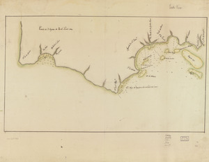
Map showing coast in the regions of Aguadilla, Añasco, and Mayagüez
182.
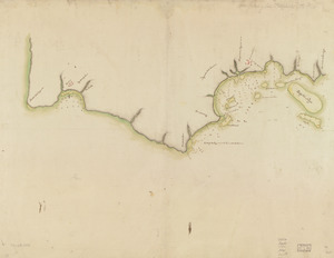
Map showing coast in the regions of Aguadilla, Añasco, and Mayagüez
183.
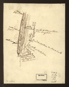
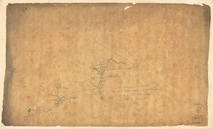
Map showing roads to Morristown
184.
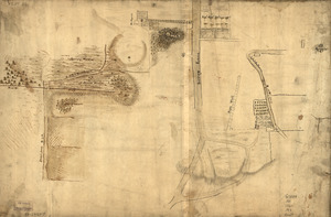
Map showing the Bowery Lane area of Manhattan
185.
Map showing the west shore of the North or Hudson River
186.
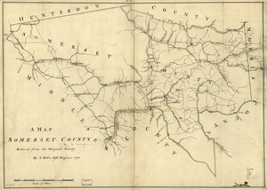
A map, Somerset County
187.
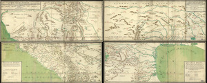
A map with part of the Florida coast from Cape Blaise to Apalachie : with the boundaries betwixt East & West Floridas, 160...
188.
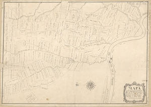
Mapa de las locaciones del Distrito de la Na Feliciana
189.
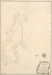
Mapa de las locaciones del Distrito de Manchack
190.
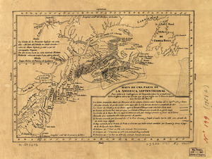
Mapa de una parte de la America Septentrional
191.
Mapa, que comprende la Frontera, de los Dominios del Rey, en la America Septentrional
192.
Marche de l'armée française de Providence à la Rivière du Nord
193.
Les marches du corps du Lord Cornwallis de Billinsport jusqu'a Philadelphia au mois de Novembre, 1777
194.
Mr. Armstrong's rough draft of the country to the west of Susquehanna
195.
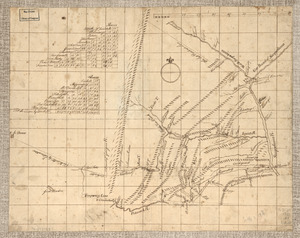
New Hampshire
196.
New York & New Jersey commissioners line from 41⁰ on Hudson's River taken in 1769
197.
New York Island : Military; unfinished
198.
New York Island and East Jersey : Unfinished
199.
New York Island. Military. Unfinished
200.
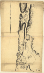
Nord de l'Ile de New-York
‹ Prev
Next ›
1
2
…
6
7
8
9
10
11
12
13
14
…
24
25