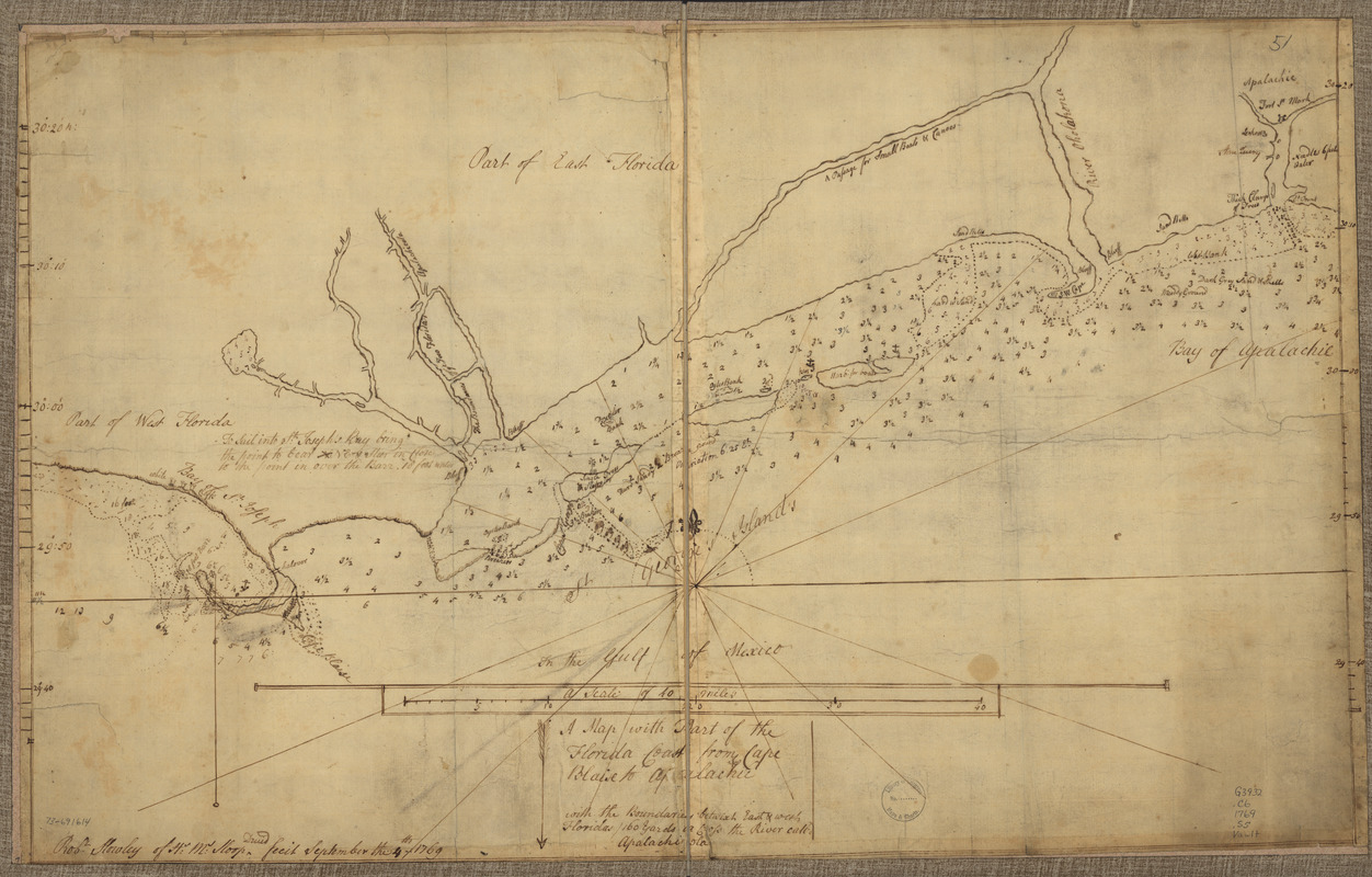
A map with part of the Florida coast from Cape Blaise to Apalachie : with the boundaries betwixt East & West Floridas, 160 yards across the river call'd Apalachicola
This map is also available in American Revolutionary Geographies Online (ARGO), a collections portal especially built for material relating to the American Revolutionary War Era. Visit ARGO to learn more about this item and explore the historical geography of North America in the late eighteenth century.
Item Information
- Title:
- A map with part of the Florida coast from Cape Blaise to Apalachie : with the boundaries betwixt East & West Floridas, 160 yards across the river call'd Apalachicola
- Title (alt.):
-
Florida coast from Cape Blaise to Apalachie
- Creator:
- Slowley, Robert
- Name on Item:
-
Robt. Slowley of Hs. Ms. sloop Druid, fecit September the 4th, 1769
- Date:
-
[1769]
- Format:
-
Maps/Atlases
Manuscripts
- Location:
- Library of Congress Geography and Map Division
- Collection (local):
-
Library of Congress Collection
- Subjects:
-
Coasts--Florida--Maps--Early works to 1800
Nautical charts--Florida--Early works to 1800
Manuscript maps--Early works to 1800
Florida--Maps--Early works to 1800
- Places:
-
Florida
- Extent:
- 1 manuscript map 46 x 74 cm.
- Terms of Use:
-
No known copyright restrictions.
This work is licensed for use under a Creative Commons Attribution Non-Commercial Share Alike License (CC BY-NC-SA).

- Scale:
-
Scale ca. 1:205,000
- Language:
-
English
- Catalog Record:
-
https://lccn.loc.gov/73691614
- Notes:
-
Manuscript, pen-and-ink.
Has watermarks.
Depths shown by soundings.
- Notes (date):
-
This date is inferred.
- Notes (citation):
-
LC Maps of North America, 1750-1789, 1626
- Identifier:
-
ar162600

![Chart of the sea coast from latitude 27⁰00ʹ00ʺ to 27⁰20ʹ00ʺ, with Little Inlet & River into Hillsborough River ; Chart of the sea coast from latitude 26⁰40ʹ00ʺ to [27⁰]00ʹ00ʺ, the Leech Shoal & Hillsborough River](https://bpldcassets.blob.core.windows.net/derivatives/images/commonwealth:q524nd97p/image_thumbnail_300.jpg)


