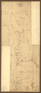
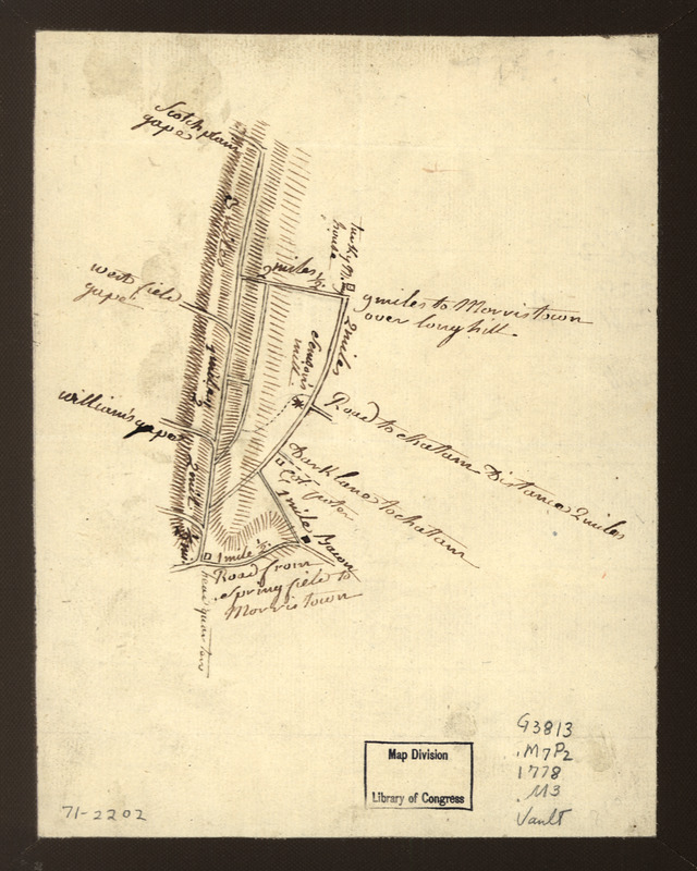
Map showing roads to Morristown
This map is also available in American Revolutionary Geographies Online (ARGO), a collections portal especially built for material relating to the American Revolutionary War Era. Visit ARGO to learn more about this item and explore the historical geography of North America in the late eighteenth century.
Item Information
- Title:
- Map showing roads to Morristown
- Date:
-
[1776?]
- Format:
-
Maps/Atlases
Manuscripts
- Location:
- Library of Congress Geography and Map Division
- Collection (local):
-
Library of Congress Collection
- Subjects:
-
Roads--New Jersey--Morris County--Maps--Early works to 1800
Roads--New Jersey--Union County--Maps--Early works to 1800
Morris County (N.J.)--Maps, Manuscript--Early works to 1800
Union County (N.J.)--Maps, Manuscript--Early works to 1800
- Places:
-
Union (county)
Morris (county)
- Extent:
- 1 manuscript map ; on sheet 21 x 16 cm.
- Terms of Use:
-
No known copyright restrictions.
This work is licensed for use under a Creative Commons Attribution Non-Commercial Share Alike License (CC BY-NC-SA).

- Scale:
-
Scale ca. 1:100,000
- Language:
-
English
- Catalog Record:
-
https://lccn.loc.gov/gm71002202
- Notes:
-
Title from Philip Lee Phillips' A list of maps of America, p. 452.
Manuscript, pen-and-ink.
Oriented with north toward the lower right.
Shows roads between Morristown and Springfield in the vicinity of Watchung Mountains, with location of "headquarters" shown on the road from Springfield to Morristown and distances between intersections.
- Notes (citation):
-
LC Maps of North America, 1750-1789, 1284
- Identifier:
-
ar128400