Toggle navigation
LMEC Home
Exhibitions
Georeferencing
Tools for Teachers
Collections
My Favorites
Sign Up / Log In
Search
Search the map portal
Map Collection
Map Collection
Map Sets
Search
Search
Search for
Search In
All Fields
Creator
Title
Subject
Place
Search All Digital Collections
Advanced Search
8768 Results
My Search
Start Over
More Like
commonwealth:q524n418c
Remove constraint More Like: commonwealth:q524n418c
Filter your Search
Place
North and Central America
5,989
United States
4,914
Massachusetts
2,105
Europe
1,396
Suffolk (county)
1,085
Boston
1,058
Canada
450
Asia
438
more
Place
»
Topic
Boston (Mass.)--Maps
586
United States--Maps
282
Real property--Massachusetts--Boston--Maps
175
Massachusetts--Maps
162
Landowners--Massachusetts--Boston--Maps
133
North America--Maps--Early works to 1800
105
New England--Maps
102
Europe--Maps
79
more
Topic
»
Date
Date range begin
–
Date range end
Current results range from
1482
to
2023
View distribution
Creator
United States. Hydrographic Office
595
O.H. Bailey & Co
148
Des Barres, Joseph F. W. (Joseph Frederick Wallet), 1722-1824
125
United States. Post Office Dept
120
Ptolemy, 2nd cent
100
Walling, Henry Francis, 1825-1888
94
Geological Survey (U.S.)
86
Jefferys, Thomas, -1771
86
more
Creator
»
Format
Maps/Atlases
8,705
Manuscripts
221
Prints
56
Books
36
Drawings/Illustrations
11
Objects/Artifacts
10
Posters
5
Georeferenced
Yes
876
No
7,892
Collection
Norman B. Leventhal Map & Education Center Collection
8,720
Boston and New England Maps
2,257
Urban Maps
2,028
Maritime Charts and Atlases
1,090
American Revolutionary War-Era Maps
683
Boston Redevelopment Authority Collection
87
Richard H. Brown Revolutionary War Map Collection at Mount Vernon
27
Mapping Boston Collection
26
more
Collection
»
Available to use
No known restrictions
8,557
Creative Commons license
111
Search Constraints
Sort by relevance
relevance
title
date (asc)
date (desc)
Number of results to display per page
20 per page
10
per page
20
per page
50
per page
100
per page
View results as:
grid view
map view
Search Results
81.
A plan of the town and harbour of Boston : and the country adjacent with the road from Boston to Concord, shewing the place of...
82.
The seat of war in New England, by an American volunteer : with the marches of the several corps sent by the Colonies towards...
83.
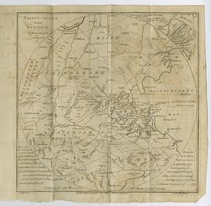
Thirty-miles round Boston
84.
An accurate map of the country round Boston in New England from the best authorities
85.
Boston, its environs and harbour, with the rebels works raised against that town in 1775
86.
Boston, S. West part : No. 25
87.
Carte von dem Hafen und der Stadt Boston : mit den umliegenden Gegenden und der Lägern sowohl der Americaner als auch des...
88.
Exact plan of General Gage's lines on Boston Neck in America
89.
Exact plan of General Gage's lines on Boston Neck in America
90.
[Map of Boston]
91.
A Map of forty miles north, thirty miles west, and twentyfive miles south of Boston : including an accurate draft of the...
92.
Map of the environs of Boston
93.
A new and correct plan of the town of Boston
94.
Order of battle of the army under the command of Lt. General Gage at Boston, July 17th, 1775
95.
Plan de Boston
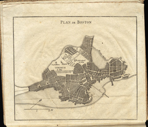
96.
A plan of Boston, and its environs : shewing the true situation of His Majesty's army, and also those of the rebels
97.
A plan of Boston, and its environs : shewing the true situation of His Majesty's army, and also those of the rebels
98.
A plan of Boston in New England with its environs : including Milton, Dorchester, Roxbury, Brooklin, Cambridge, Medford,...
99.
A plan of Boston in New England with its environs : including Milton, Dorchester, Roxbury, Brooklin, Cambridge, Medford,...
100.
A plan of the action at Bunkers Hill, on the 17th. of June, 1775 : between His Majesty's troops under the command of Major...
‹ Prev
Next ›
1
2
3
4
5
6
7
8
9
…
438
439


![[Map of Boston]](https://bpldcassets.blob.core.windows.net/derivatives/images/commonwealth:z603vw17n/image_thumbnail_300.jpg)