Toggle navigation
LMEC Home
Exhibitions
Georeferencing
Tools for Teachers
Collections
My Favorites
Sign Up / Log In
Search
Search the map portal
Map Collection
Map Collection
Map Sets
Search
Search
Search for
Search In
All Fields
Creator
Title
Subject
Place
Search All Digital Collections
Advanced Search
8704 Results
My Search
Start Over
More Like
commonwealth:q524n361f
Remove constraint More Like: commonwealth:q524n361f
Filter your Search
Place
North and Central America
5,927
United States
4,845
Massachusetts
2,079
Europe
1,396
Suffolk (county)
1,047
Boston
1,020
Canada
449
Asia
438
more
Place
»
Topic
Boston (Mass.)--Maps
587
United States--Maps
282
Real property--Massachusetts--Boston--Maps
175
Massachusetts--Maps
162
Landowners--Massachusetts--Boston--Maps
133
North America--Maps--Early works to 1800
103
New England--Maps
102
World maps
82
more
Topic
»
Date
Date range begin
–
Date range end
Current results range from
1482
to
2023
View distribution
Creator
United States. Hydrographic Office
595
O.H. Bailey & Co
148
Des Barres, Joseph F. W. (Joseph Frederick Wallet), 1722-1824
123
United States. Post Office Dept
120
Ptolemy, 2nd cent
100
Walling, Henry Francis, 1825-1888
94
Geological Survey (U.S.)
86
Jefferys, Thomas, -1771
85
more
Creator
»
Format
Maps/Atlases
8,644
Manuscripts
218
Prints
56
Books
36
Objects/Artifacts
10
Drawings/Illustrations
8
Posters
5
Georeferenced
Yes
869
No
7,835
Collection
Norman B. Leventhal Map & Education Center Collection
8,701
Boston and New England Maps
2,235
Urban Maps
2,024
Maritime Charts and Atlases
1,083
American Revolutionary War-Era Maps
616
Boston Redevelopment Authority Collection
88
Sidney R. Knafel Map Collection at Phillips Academy
2
Available to use
No known restrictions
8,555
Creative Commons license
50
Search Constraints
Sort by relevance
relevance
title
date (asc)
date (desc)
Number of results to display per page
20 per page
10
per page
20
per page
50
per page
100
per page
View results as:
grid view
map view
Search Results
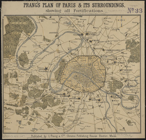
6861.
Prang's plan of Paris & its surroundings, showing all fortifications
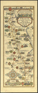
6862.
Pratts high test map of the Great North Road
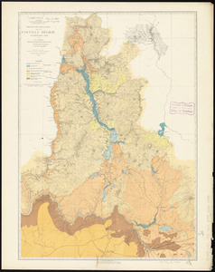
6863.
Preliminary agricultural map of Colville Region, Washington Ter.
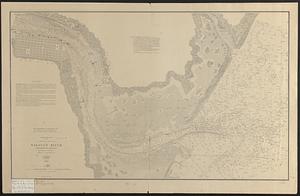
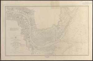
6864.
Preliminary chart : lower reach of Saginaw River and bar in front
6865.
Preliminary chart, lower reach of Saginaw River and bar in front, (Saginaw Bay, Lake Huron)
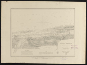
6866.
Preliminary chart of Agate Harbor, Lake Superior
6867.
Preliminary chart of Agate Harbor, Lake Superior
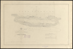
6868.
Preliminary chart of Copper Harbor
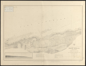
6869.
Preliminary chart of Eagle Harbor, Lake Superior : from surveys under the direction of the Topographical Bureau of the War...
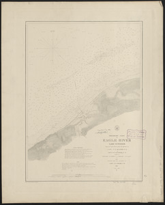
6870.
Preliminary chart of Eagle River, Lake Superior
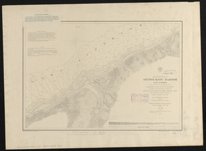
6871.
Preliminary chart of Ontonagon Harbor, Lake Superior : from surveys under the direction of the Topographical Bureau of the War...
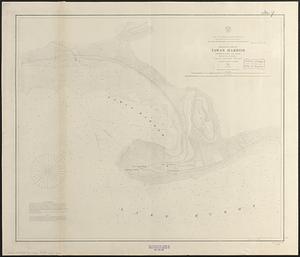
6872.
Preliminary chart of Tawas Harbor : (harbor of refuge, Lake Huron)
6873.
Preliminary chart of Tawas Harbor : (harbor of refuge, Lake Huron)
6874.
Preliminary geological map of Connecticut
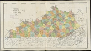
6875.
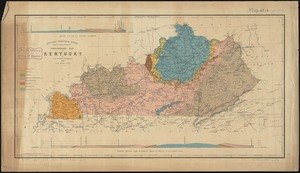
Preliminary map of Kentucky
6876.
Preliminary map of Kentucky
6877.
Preliminary map of south east Kentucky
6878.
Preliminary plan for the extension of Commonwealth Avenue along Beacon Street Brookline : showing connection with Chestnut Hill...
6879.
Preliminary plan for widening Beacon Street from the Back Bay district of Boston to the public pleasure ground at Chestnut Hill...
6880.
Preliminary plan for widening Chestnut Hill Avenue
‹ Prev
Next ›
1
2
…
340
341
342
343
344
345
346
347
348
…
435
436