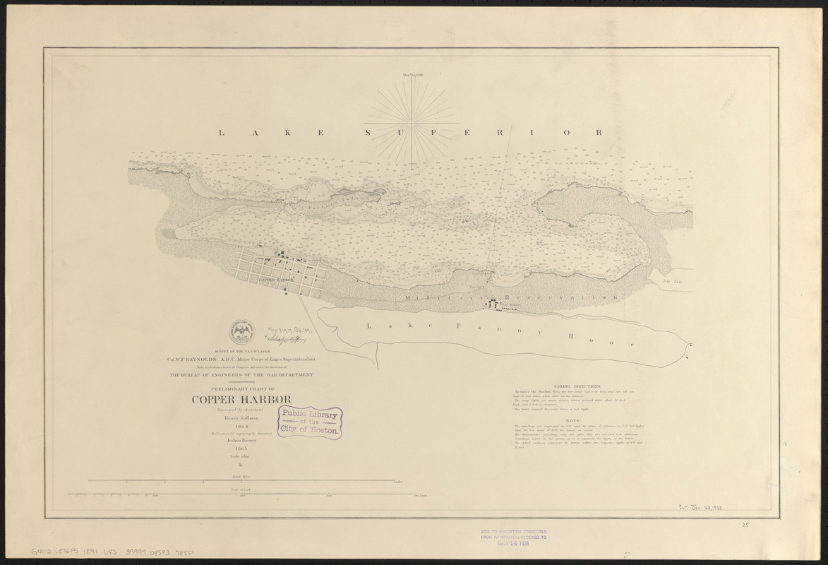
Preliminary chart of Copper Harbor
Item Information
- Title:
- Preliminary chart of Copper Harbor
- Issuing body:
- U.S. Lake Survey
- Surveyor:
- Gillman, Henry, 1833-1915
- Draftsman:
- Barney, Joshua, 1799 or 1800-1867
- Name on Item:
-
surveyed by assistant Henry Gillman 1864 ; reduction for engraving by assistant Joshua Barney 1865
- Date:
-
1891
- Format:
-
Maps/Atlases
- Location:
-
Boston Public Library
Norman B. Leventhal Map & Education Center - Collection (local):
-
Norman B. Leventhal Map & Education Center Collection
- Subjects:
-
Nautical charts--Michigan--Copper Harbor (Bay)
Nautical charts--Superior, Lake
Copper Harbor (Mich.)--Maps
Copper Harbor (Mich. : Bay)--Maps
- Places:
-
MichiganKeweenaw (county)Copper Harbor (bay)
MichiganKeweenaw (county)Copper Harbor
- Extent:
- 1 map ; 40 x 62 cm
- Terms of Use:
-
No known copyright restrictions.
No known restrictions on use.
- Publisher:
-
[Washington, D.C.] :
[U.S. Lake Survey]
- Scale:
-
Scale 1:10,000
- Language:
-
English
- Notes:
-
Depths shown by soundings and isolines.
Includes sailing directions and note.
Seal with "United States Lake Survey 1866" at head of title.
Stamped in bottom margin: Aidsd to navigation corrected from information received to May 14 1891.
- Identifier:
-
06_01_015609
- Call #:
-
G4112.C72P5 1891 .U83
- Barcode:
-
39999085937850


