Toggle navigation
LMEC Home
Exhibitions
Georeferencing
Tools for Teachers
Collections
My Favorites
Sign Up / Log In
Search
Search the map portal
Map Collection
Map Collection
Map Sets
Search
Search
Search for
Search In
All Fields
Creator
Title
Subject
Place
Search All Digital Collections
Advanced Search
8878 Results
My Search
Start Over
More Like
commonwealth:pc28d1265
Remove constraint More Like: commonwealth:pc28d1265
Filter your Search
Place
North and Central America
6,109
United States
5,025
Massachusetts
2,137
Europe
1,396
Suffolk (county)
1,224
Boston
1,197
Canada
449
Asia
438
more
Place
»
Topic
Boston (Mass.)--Maps
752
United States--Maps
282
Real property--Massachusetts--Boston--Maps
195
City planning--Massachusetts--Boston--Maps
172
Massachusetts--Maps
166
Landowners--Massachusetts--Boston--Maps
142
New England--Maps
104
North America--Maps--Early works to 1800
103
more
Topic
»
Date
Date range begin
–
Date range end
Current results range from
1482
to
2023
View distribution
Creator
United States. Hydrographic Office
595
Boston Redevelopment Authority
174
O.H. Bailey & Co
148
Des Barres, Joseph F. W. (Joseph Frederick Wallet), 1722-1824
124
United States. Post Office Dept
120
Ptolemy, 2nd cent
100
Walling, Henry Francis, 1825-1888
94
Geological Survey (U.S.)
87
more
Creator
»
Format
Maps/Atlases
8,818
Manuscripts
215
Prints
56
Books
36
Objects/Artifacts
10
Drawings/Illustrations
8
Posters
5
Georeferenced
Yes
885
No
7,993
Collection
Norman B. Leventhal Map & Education Center Collection
8,725
Boston and New England Maps
2,375
Urban Maps
2,157
Maritime Charts and Atlases
1,083
American Revolutionary War-Era Maps
638
Boston Redevelopment Authority Collection
206
Mapping Boston Collection
20
Massachusetts Real Estate Atlases
12
more
Collection
»
Available to use
No known restrictions
8,681
Creative Commons license
70
Search Constraints
Sort by relevance
relevance
title
date (asc)
date (desc)
Number of results to display per page
20 per page
10
per page
20
per page
50
per page
100
per page
View results as:
grid view
map view
Search Results
4861.
A map of the towns of Dorchester and Milton, 1831
4862.
Map of the towns of Gloucester and Rockport, Essex Co., Massachusetts
4863.
Map of the townships of Hamilton & Cox, Bay of Chaleurs, District of Caspé, Lower Canada
4864.
Map of the Troy & Greenfield Rail Road and its connections
4865.
Map of the United Counties of Leeds and Grenville, Canada West
4866.
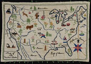
Map of the United States
4867.
Map of the United States : intending chiefly to exhibit the post roads & distances
4868.
Map of the United States
4869.
Map of the United States
4870.
Map of the United States
4871.
A map of the United States
4872.
A map of the United States : compiled chiefly from the state maps, and other authentic information
4873.
Map of the United States
4874.
Map of the United States
4875.
A map of the United States and Canada, New-Scotland, New-Brunswick and New-Foundland = Carte des Etats-Unis avec le Canada, la...
4876.
Map of the United States and territories, showing the extent of public surveys and other details
4877.
Map of the United States and territories, showing the extent of public surveys and other details constructed from the plats and...
4878.
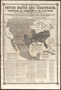
Map of the United States and territories, showing the possessions and aggressions of the slave power
4879.
Map of the United States and territories with adjacent parts of Canada and Mexico, also part of the West India Islands :...
4880.
Map of the United States and their territories between the Mississippi and the Pacific Ocean; and part of Mexico
‹ Prev
Next ›
1
2
…
240
241
242
243
244
245
246
247
248
…
443
444