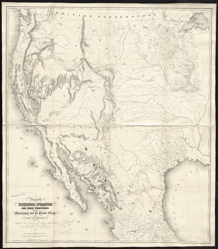
Map of the United States and their territories between the Mississippi and the Pacific Ocean; and part of Mexico
Item Information
- Title:
- Map of the United States and their territories between the Mississippi and the Pacific Ocean; and part of Mexico
- Creator:
- United States. Topographical Engineers
- Name on Item:
-
compiled in the Bureau of the Corps of Topogl. Engs. under a resolution of the U.S. Senate, from the best authorities which could be obtained.
- Date:
-
1850
- Format:
-
Maps/Atlases
- Location:
-
Boston Public Library
Norman B. Leventhal Map & Education Center - Collection (local):
-
Norman B. Leventhal Map & Education Center Collection
- Subjects:
-
West (U.S.)--Maps
- Places:
-
Western United States (area)
- Extent:
- 1 map ; 110 x 97 cm.
- Terms of Use:
-
No known copyright restrictions.
No known restrictions on use.
- Publisher:
-
[Washington, D.C.] :
The Corps
- Scale:
-
Scale [ca. 1:3,200,000]
- Language:
-
English
- Notes:
-
Relief shown by hachures.
- Identifier:
-
06_01_008772
- Call #:
-
G4050 1850 .I55
- Barcode:
-
39999065656108


