Toggle navigation
LMEC Home
Exhibitions
Georeferencing
Tools for Teachers
Collections
My Favorites
Sign Up / Log In
Search
Search the map portal
Map Collection
Map Collection
Map Sets
Search
Search
Search for
Search In
All Fields
Creator
Title
Subject
Place
Search All Digital Collections
Advanced Search
245 Results
My Search
Start Over
More Like
commonwealth:p8418t713
Remove constraint More Like: commonwealth:p8418t713
Filter your Search
Place
United States
240
North and Central America
232
New England
97
Boston
81
Suffolk (county)
81
Massachusetts
76
Boston Harbor
40
Canada
26
more
Place
»
Topic
New England--Maps--Early works to 1800
97
Boston (Mass.)--Maps--Early works to 1800
49
Boston Harbor (Mass.)--Maps--Early works to 1800
39
United States--History--Revolution, 1775-1783--Maps--Early works to 1800
38
Boston (Mass.)--History--Revolution, 1775-1783--Maps--Early works to 1800
29
Bunker Hill, Battle of, Boston, Mass., 1775--Maps--Early works to 1800
20
Middle Atlantic States--Maps--Early works to 1800
20
Fortification--Massachusetts--Boston--Maps--Early works to 1800
14
more
Topic
»
Date
Date range begin
–
Date range end
Current results range from
1617
to
1999
View distribution
Creator
Page, Thomas Hyde, Sir, 1746-1821
12
Faden, William, 1749-1836
11
Jefferys, Thomas, d. 1771
9
Robert Sayer and John Bennett (Firm)
8
Bellin, Jacques Nicolas, 1703-1772
7
Jefferys, Thomas, -1771
6
Lattré, Jean
6
Bowles, Carington, 1724-1793
5
more
Creator
»
Format
Maps/Atlases
243
Manuscripts
20
Drawings/Illustrations
2
Georeferenced
Yes
18
No
227
Collection
American Revolutionary War-Era Maps
184
Norman B. Leventhal Map & Education Center Collection
137
Boston and New England Maps
90
Mapping Boston Collection
47
Richard H. Brown Revolutionary War Map Collection at Mount Vernon
29
Urban Maps
26
New-York Historical Society Collection
24
Maritime Charts and Atlases
22
more
Collection
»
Available to use
No known restrictions
116
Creative Commons license
101
Search Constraints
Sort by relevance
relevance
title
date (asc)
date (desc)
Number of results to display per page
20 per page
10
per page
20
per page
50
per page
100
per page
View results as:
grid view
map view
Search Results
21.
Hafen von Boston
22.
A new and accurate plan of the town of Boston in New England : A new plan of Boston Harbor from an actual survey
23.
Plan de la ville de Boston et ses environs
24.
Plan de la ville et du port de Boston : capitale de la Nouvelle Angleterre : erigée prémierement en 1630, et en 1735 elle fut...
25.
A plan of the town and chart of the harbour of Boston exhibiting a view of the islands, castle forts, and entrances into the...
26.
Karte von Neu England, Neu Yorck und Pensilvanien
27.
A new and accurate map of the present seat of war in North America : from a late survey
28.
A map of the most inhabited part of New England : containing the provinces of Massachusets Bay and New Hampshire, with the...
29.
A map of 100 miles round Boston
30.
The Country twenty five miles round New York
31.
A plan of the operations of the King's army under the command of General Sr. William Howe, K.B. in New York and east New...
32.
Plan d'une partie de la rade de Boston pour faire connaitre le dispositif de ses deffenses
33.
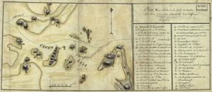
[Rough draught of Boston and harbour]
34.
Krigs theatreni i America, 1777 = : seat of war in America, 1777
35.
A new and accurate map of the province of New York and part of the Jerseys, New England and Canada, shewing the scenes of our...
36.
Exact plan of General Gage's lines on Boston Neck in America
37.
Exact plan of General Gage's lines on Boston Neck in America
38.
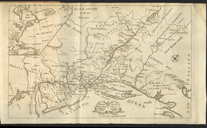
[Map of Boston]
39.
Order of battle of the army under the command of Lt. General Gage at Boston, July 17th, 1775
40.
A plan of the town of Boston with the intrenchments & ca. of His Majesty's forces in 1775 : from the observations of Lieut....
‹ Prev
Next ›
1
2
3
4
5
6
…
12
13


![[Rough draught of Boston and harbour]](https://bpldcassets.blob.core.windows.net/derivatives/images/commonwealth:z603vj39m/image_thumbnail_300.jpg)


![[Map of Boston]](https://bpldcassets.blob.core.windows.net/derivatives/images/commonwealth:z603vw17n/image_thumbnail_300.jpg)

