Toggle navigation
LMEC Home
Exhibitions
Georeferencing
Tools for Teachers
Collections
My Favorites
Sign Up / Log In
Search
Search the map portal
Map Collection
Map Collection
Map Sets
Search
Search
Search for
Search In
All Fields
Creator
Title
Subject
Place
Search All Digital Collections
Advanced Search
8706 Results
My Search
Start Over
More Like
commonwealth:kk91fr88r
Remove constraint More Like: commonwealth:kk91fr88r
Filter your Search
Place
North and Central America
5,937
United States
4,850
Massachusetts
2,078
Europe
1,396
Suffolk (county)
1,045
Boston
1,018
Canada
449
Asia
438
more
Place
»
Topic
Boston (Mass.)--Maps
586
United States--Maps
282
Real property--Massachusetts--Boston--Maps
175
Massachusetts--Maps
162
Landowners--Massachusetts--Boston--Maps
133
North America--Maps--Early works to 1800
103
New England--Maps
102
Europe--Maps
79
more
Topic
»
Date
Date range begin
–
Date range end
Current results range from
1482
to
2023
View distribution
Creator
United States. Hydrographic Office
595
O.H. Bailey & Co
148
Des Barres, Joseph F. W. (Joseph Frederick Wallet), 1722-1824
123
United States. Post Office Dept
120
Ptolemy, 2nd cent
100
Walling, Henry Francis, 1825-1888
94
Geological Survey (U.S.)
86
Jefferys, Thomas, -1771
86
more
Creator
»
Format
Maps/Atlases
8,646
Manuscripts
215
Prints
56
Books
36
Objects/Artifacts
10
Drawings/Illustrations
8
Posters
5
Georeferenced
Yes
869
No
7,837
Collection
Norman B. Leventhal Map & Education Center Collection
8,693
Boston and New England Maps
2,232
Urban Maps
2,023
Maritime Charts and Atlases
1,083
American Revolutionary War-Era Maps
628
Boston Redevelopment Authority Collection
87
William L. Clements Library Collection
8
American Antiquarian Society Collection
5
Available to use
No known restrictions
8,551
Creative Commons license
47
Search Constraints
Sort by relevance
relevance
title
date (asc)
date (desc)
Number of results to display per page
20 per page
10
per page
20
per page
50
per page
100
per page
View results as:
grid view
map view
Search Results
1.
Map of Hampton Roads and Norfolk Harbor : showing the location of Fortress Monroe & Forts Calhoun & Norfolk : from the latest...
2.
Bacon's Map of the seat of war in Virginia : showing minutely the interesting localities in the vicinity of Richmond
3.
Coast of North Carolina & Virginia
4.
Colton's new topographical map of the states of Virginia, Maryland & Delaware, showing also eastern Tennessee & parts of other...
5.
Colton's new topographical map of the states of Virginia, West Virginia, Maryland & Delaware and portions of other adjoining...
6.
Eastern Virginia from Fredericksburg to Richmond
7.
Johnson's Virginia, Delaware, Maryland & West Virginia
8.
The Keystone group : a new railroad, post-office, township and district map of Pennsylvania, New Jersey, Delaware, Maryland,...
9.
Lloyd's official map of the state of Virginia from actual surveys by order of the Executive, 1828 & 1859
10.
Map of eastern Virginia
11.
Map of eastern Virginia
12.
Map of n. eastern Virginia and vicinity of Washington
13.
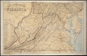
Map of the State of Virginia
14.
Map of the State of Virginia
15.
Map of the vicinity of Yorktown, Virginia, 1881
16.
Map of the Virginian Railway
17.
Map of Virginia and Maryland, constructed from the latest authorities
18.
Map of Virginia and West Virginia
19.
Map of Virginia, West Virginia and Ohio : showing Norfolk and Western Railway : main line branches and connections
20.
Middle Virginia and North Carolina
‹ Prev
Next ›
1
2
3
4
5
…
435
436