Toggle navigation
LMEC Home
Exhibitions
Georeferencing
Tools for Teachers
Collections
My Favorites
Sign Up / Log In
Search
Search the map portal
Map Collection
Map Collection
Map Sets
Search
Search
Search for
Search In
All Fields
Creator
Title
Subject
Place
Search All Digital Collections
Advanced Search
8563 Results
My Search
Start Over
More Like
commonwealth:kk91fq60v
Remove constraint More Like: commonwealth:kk91fq60v
Date facet yearly ssim
1820
to
1824
Remove constraint Date facet yearly ssim: <span class='from'>1820</span> to <span class='to'>1824</span>
Filter your Search
Place
North and Central America
5,856
United States
4,776
Massachusetts
2,052
Europe
1,359
Suffolk (county)
1,034
Boston
1,007
Canada
450
Asia
422
more
Place
»
Topic
Boston (Mass.)--Maps
577
United States--Maps
273
Real property--Massachusetts--Boston--Maps
174
Massachusetts--Maps
160
Landowners--Massachusetts--Boston--Maps
132
North America--Maps--Early works to 1800
103
New England--Maps
99
Europe--Maps
78
more
Topic
»
Date
Date range begin
–
Date range end
Current results range from
1482
to
2023
View distribution
Creator
United States. Hydrographic Office
594
O.H. Bailey & Co
148
Des Barres, Joseph F. W. (Joseph Frederick Wallet), 1722-1824
124
United States. Post Office Dept
120
Ptolemy, 2nd cent
100
Walling, Henry Francis, 1825-1888
94
Geological Survey (U.S.)
86
Jefferys, Thomas, -1771
86
more
Creator
»
Format
Maps/Atlases
8,504
Manuscripts
215
Prints
56
Books
36
Objects/Artifacts
10
Drawings/Illustrations
8
Posters
4
Georeferenced
Yes
869
No
7,694
Collection
Norman B. Leventhal Map & Education Center Collection
8,555
Boston and New England Maps
2,205
Urban Maps
1,936
Maritime Charts and Atlases
1,085
American Revolutionary War-Era Maps
624
Boston Redevelopment Authority Collection
87
Mapping Boston Collection
6
Richard H. Brown Revolutionary War Map Collection at Mount Vernon
5
more
Collection
»
Available to use
No known restrictions
8,408
Creative Commons license
58
Search Constraints
Sort by date (asc)
relevance
title
date (asc)
date (desc)
Number of results to display per page
20 per page
10
per page
20
per page
50
per page
100
per page
View results as:
grid view
map view
Search Results
8121.
Downtown district of Manhattan
8122.
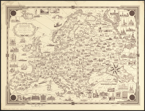
Europe : a pictorial map
8123.
Lake Champlain streamline ferries : direct routes to Whiteface Mtn., Ausable Chasm, scenic short-cuts between Green Mountains,...
8124.
Midsummer's marvels
8125.
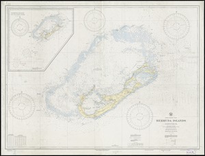
North Atlantic Ocean, Bermuda Islands : from British surveys to 1926, with additions and corrections to 1936
8126.
Now see America by Grace Line
8127.
Limited edition, 500 only of a pictorial map covering the New England States U.S.A
8128.
Map of Scituate Rhode Island
8129.
Pictorial map of Mexico
8130.
A pictorial map of that portion of New York City known as Manhattan, also showing parts of the Bronx
8131.
A pictorial map of the British Isles
8132.
A pictorial map of the New England states U.S.A.
8133.
PWA rebuilds the nation
8134.
Shall Union Square overshadow the United States? : America's other 60 families : the real rulers of America
8135.
World wonders : a pictorial map
8136.
38,000,000 escaped -- 10,000,000 died
8137.
America the wonderland : a pictorial map of the United States
8138.
Art forms of the Pacific area
8139.
Boston Elevated Railway system route map
8140.
A map of Cape Cod
‹ Prev
Next ›
1
2
…
403
404
405
406
407
408
409
410
411
…
428
429