Toggle navigation
LMEC Home
Exhibitions
Georeferencing
Tools for Teachers
Collections
My Favorites
Sign Up / Log In
Search
Search the map portal
Map Collection
Map Collection
Map Sets
Search
Search
Search for
Search In
All Fields
Creator
Title
Subject
Place
Search All Digital Collections
Advanced Search
8938 Results
My Search
Start Over
More Like
commonwealth:js956k875
Remove constraint More Like: commonwealth:js956k875
Filter your Search
Place
North and Central America
6,169
United States
5,085
Massachusetts
2,128
Europe
1,396
Suffolk (county)
1,284
Boston
1,257
Canada
449
Asia
438
more
Place
»
Topic
Boston (Mass.)--Maps
752
United States--Maps
282
City planning--Massachusetts--Boston--Maps
224
Real property--Massachusetts--Boston--Maps
208
Massachusetts--Maps
166
Landowners--Massachusetts--Boston--Maps
145
Urban renewal--Massachusetts--Boston--Maps
133
New England--Maps
104
more
Topic
»
Date
Date range begin
–
Date range end
Current results range from
1482
to
2023
View distribution
Creator
United States. Hydrographic Office
595
Boston Redevelopment Authority
227
O.H. Bailey & Co
148
Des Barres, Joseph F. W. (Joseph Frederick Wallet), 1722-1824
124
United States. Post Office Dept
120
Ptolemy, 2nd cent
100
Walling, Henry Francis, 1825-1888
94
Geological Survey (U.S.)
87
more
Creator
»
Format
Maps/Atlases
8,878
Manuscripts
215
Prints
56
Books
36
Objects/Artifacts
10
Drawings/Illustrations
8
Posters
5
Georeferenced
Yes
885
No
8,053
Collection
Norman B. Leventhal Map & Education Center Collection
8,724
Boston and New England Maps
2,431
Urban Maps
2,214
Maritime Charts and Atlases
1,083
American Revolutionary War-Era Maps
638
Boston Redevelopment Authority Collection
264
Mapping Boston Collection
20
Massachusetts Real Estate Atlases
15
more
Collection
»
Available to use
No known restrictions
8,738
Creative Commons license
70
Search Constraints
Sort by relevance
relevance
title
date (asc)
date (desc)
Number of results to display per page
20 per page
10
per page
20
per page
50
per page
100
per page
View results as:
grid view
map view
Search Results
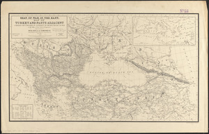
7541.
Seat of war in the east : map of Turkey and parts adjacent
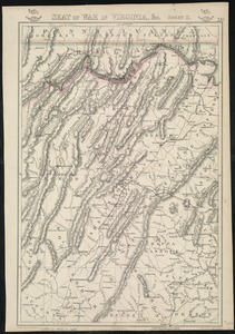
7542.
Seat of war in Virginia
7543.
Seat of war in Virginia and Maryland
7544.
Seat of war in Virginia, &c
7545.
The seat of war in ye North : or a map of the Baltick, with part of the North Sea ... posture of affaris
7546.
The seat of war in ye North : or a map of the Baltick, with part of the North Sea ... posture of affaris
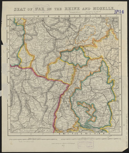
7547.
Seat of war on the Rhine and Moselle
7548.
The seat of war on the Rhine being a new map of the course of that river from Basil to Bonn with the adjacent countries
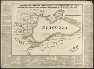
7549.
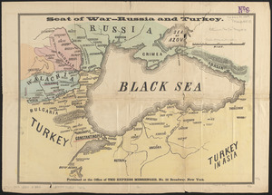
Seat of war--Russia and Turkey
7550.
Seat of war--Russia and Turkey
7551.
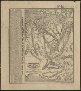
Sebastopol and Balaklava shewing the position of the allied forces
7552.
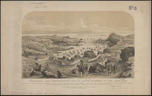
Sebastopol, and fortifications now in active progress on the land side
7553.
Second part of Asia : being China, part of India and Tartary, the islands of Sonda, Molucka, Philippin, Japan &c. ; performed...
7554.
The second section of the survey of 1819
7555.
Sect: Düsseldorf
7556.
Section 16: Chemnitz
7557.
Section 16: Chemnitz
7558.
Section of a track chart of the world, covering the Behring Sea
7559.
Sectional & topographical map of Holmes County, Ohio
7560.
A sectional map of Massachusetts, engraved expressly for Chapin's farm advertiser, 1871 : including the proposed Massachusetts...
‹ Prev
Next ›
1
2
…
374
375
376
377
378
379
380
381
382
…
446
447