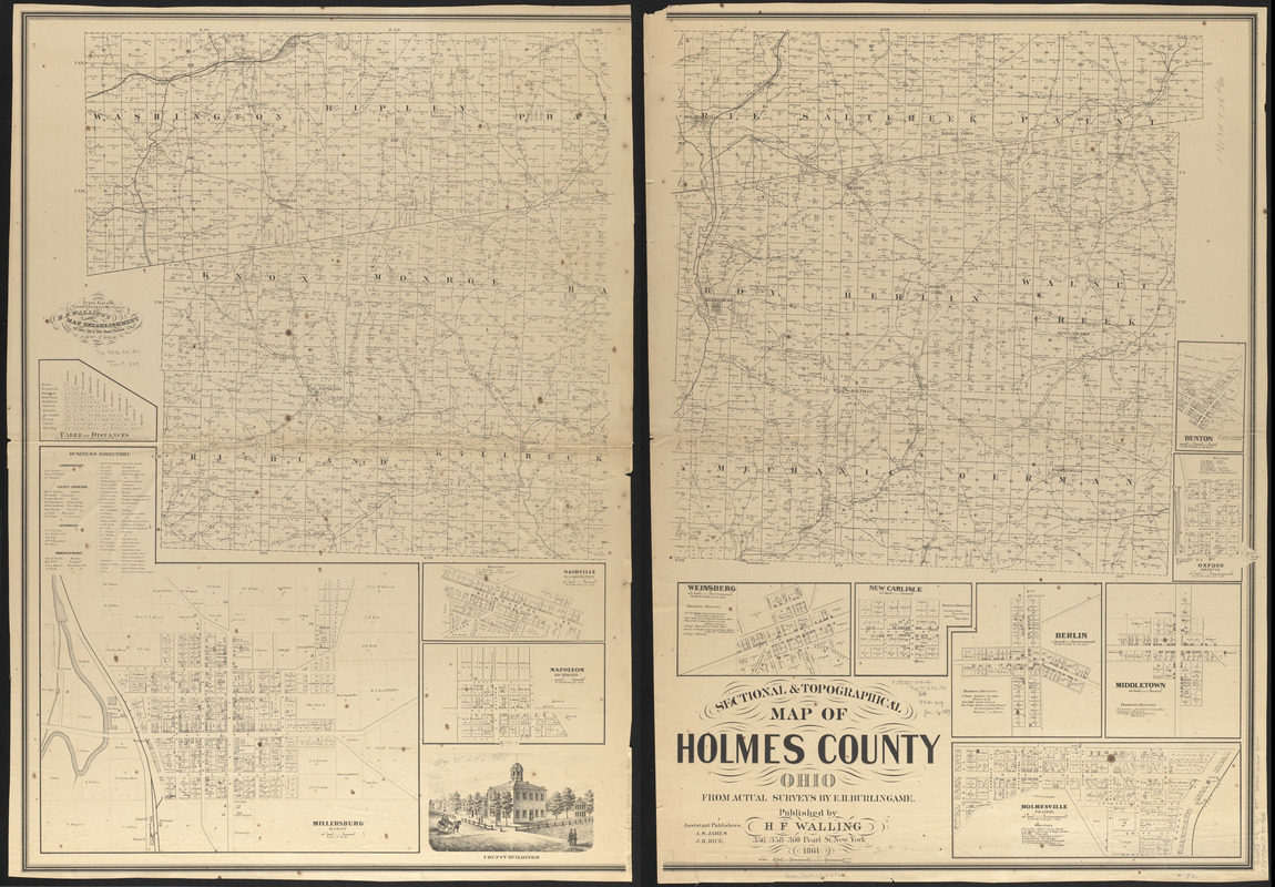
Sectional & topographical map of Holmes County, Ohio
Item Information
- Title:
- Sectional & topographical map of Holmes County, Ohio
- Title (alt.):
-
Sectional and topographical map of Holmes County, Ohio
- Cartographer:
- Burlingame, E. H.
- Publisher:
- Walling, Henry Francis, 1825-1888
- Name on Item:
-
from actual surveys by E.H. Burlingame ; assistant publishrs, A.S. James, J.R. Rice. ; drawn, engraved, printed, colored, and mounted at H.F. Wallings, Map Establishment
- Date:
-
1861
- Format:
-
Maps/Atlases
- Location:
-
Boston Public Library
Norman B. Leventhal Map & Education Center - Collection (local):
-
Norman B. Leventhal Map & Education Center Collection
- Subjects:
-
Landowners--Ohio--Holmes County--Maps
Real property--Ohio--Holmes County--Maps
Cities and towns--Ohio--Holmes County--Maps
Holmes County (Ohio)--Maps
- Places:
-
OhioHolmes (county)
- Extent:
- 1 map on 2 sheets ; 97 x 132 cm, sheets 101 x 70 cm
- Terms of Use:
-
No known copyright restrictions.
No known restrictions on use.
- Publisher:
-
New York :
H.F. Walling
- Scale:
-
Scale approximately 1:40,000
- Language:
-
English
- Notes:
-
Includes distance table, 9 insets and a view of public building.
Insets: Millersburg, Hardy -- Nashville, Washington -- Napoleon, Richmond -- Weinsberg -- New Carlisle -- Berlin -- Middletown -- Holmesville, Prairie -- Benton -- Oxford, Killbuck.
- Notes (citation):
-
LC Land ownership maps, 641
- Identifier:
-
06_01_011310
- Call #:
-
G4093.H8 1861 .B87
- Barcode:
-
39999065683300


