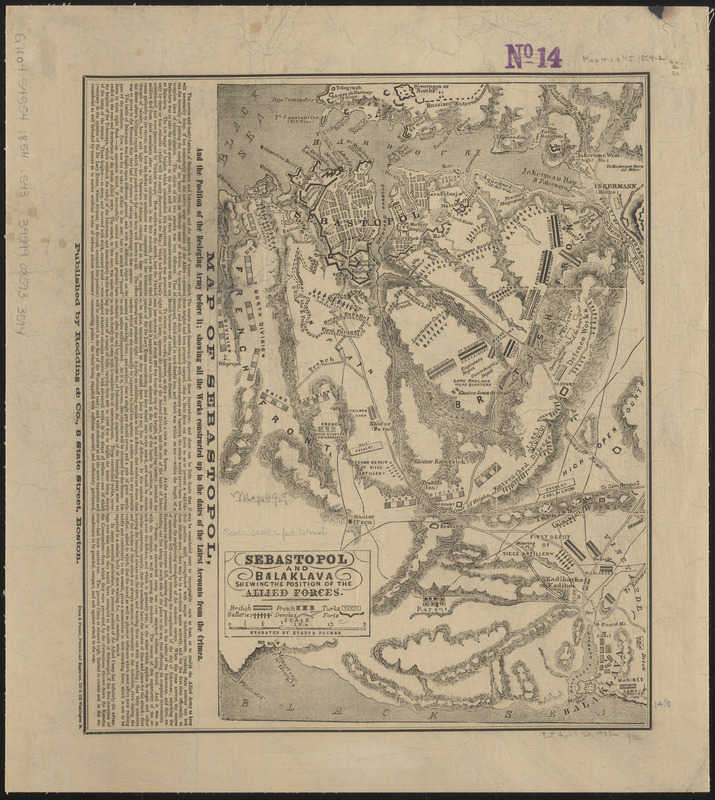
Sebastopol and Balaklava shewing the position of the allied forces
Item Information
- Title:
- Sebastopol and Balaklava shewing the position of the allied forces
- Title (alt.):
-
Map of Sebastopol, and the position of the besieging army before it : showing all the works constructed up to the dates of the latest accounts from the Crimea
- Publisher:
- Redding & Co.
- Engraver:
- Evans & Plumer
- Name on Item:
-
engraved by Evans & Plumer
- Date:
-
[ca. 1854–1855]
- Format:
-
Maps/Atlases
- Location:
-
Boston Public Library
Norman B. Leventhal Map & Education Center - Collection (local):
-
Norman B. Leventhal Map & Education Center Collection
- Subjects:
-
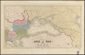
Crimean War, 1853-1856--Maps
Sevastopolʹ (Ukraine)--History--Siege, 1854-1855--Maps
- Places:
-
UkraineSevastopol'
- Extent:
- 1 map ; 36 x 24 cm, on sheet 44 x 40 cm
- Terms of Use:
-
No known copyright restrictions.
No known restrictions on use.
- Publisher:
-
Boston :
Redding & Co.
- Scale:
-
Scale approximately 1:43,000
- Language:
-
English
- Notes:
-
Relief shown by hachures.
Shows positions of the British, French and Turkish forces, and forts, batteries and trenches.
Includes text.
- Identifier:
-
06_01_015213
- Call #:
-
G7104.S4S54 1854 .S43
- Barcode:
-
39999085933594