Toggle navigation
LMEC Home
Exhibitions
Georeferencing
Tools for Teachers
Collections
My Favorites
Sign Up / Log In
Search
Search the map portal
Map Collection
Map Collection
Map Sets
Search
Search
Search for
Search In
All Fields
Creator
Title
Subject
Place
Search All Digital Collections
Advanced Search
8700 Results
My Search
Start Over
More Like
commonwealth:jh343z738
Remove constraint More Like: commonwealth:jh343z738
Filter your Search
Place
North and Central America
5,927
United States
4,844
Massachusetts
2,079
Europe
1,396
Suffolk (county)
1,046
Boston
1,019
Canada
449
Asia
438
more
Place
»
Topic
Boston (Mass.)--Maps
586
United States--Maps
282
Real property--Massachusetts--Boston--Maps
175
Massachusetts--Maps
162
Landowners--Massachusetts--Boston--Maps
133
North America--Maps--Early works to 1800
107
New England--Maps
102
Europe--Maps
79
more
Topic
»
Date
Date range begin
–
Date range end
Current results range from
1482
to
2023
View distribution
Creator
United States. Hydrographic Office
595
O.H. Bailey & Co
148
Des Barres, Joseph F. W. (Joseph Frederick Wallet), 1722-1824
123
United States. Post Office Dept
120
Ptolemy, 2nd cent
100
Walling, Henry Francis, 1825-1888
94
Geological Survey (U.S.)
86
Jefferys, Thomas, -1771
86
more
Creator
»
Format
Maps/Atlases
8,640
Manuscripts
215
Prints
56
Books
36
Objects/Artifacts
10
Drawings/Illustrations
8
Posters
5
Georeferenced
Yes
869
No
7,831
Collection
Norman B. Leventhal Map & Education Center Collection
8,695
Boston and New England Maps
2,233
Urban Maps
2,023
Maritime Charts and Atlases
1,083
American Revolutionary War-Era Maps
620
Boston Redevelopment Authority Collection
87
Richard H. Brown Revolutionary War Map Collection at Mount Vernon
3
MacLean Collection Map Library
1
more
Collection
»
Available to use
No known restrictions
8,552
Creative Commons license
51
Search Constraints
Sort by relevance
relevance
title
date (asc)
date (desc)
Number of results to display per page
20 per page
10
per page
20
per page
50
per page
100
per page
View results as:
grid view
map view
Search Results
3641.
Map of Japan
3642.
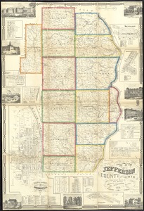
Map of Jefferson County, Ohio : from actual surveys
3643.
Map of Jeffersonville enlarged
3644.
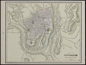
Map of Jerusalem : reduced from the Ordnance Survey ; Smyrna ; the Maltese Islands
3645.
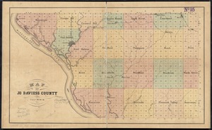
Map of Jo Daviess County, Illinois
3646.
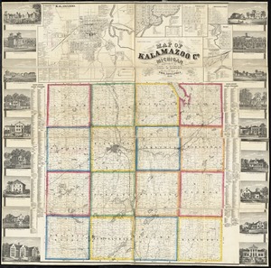
Map of Kalamazoo Co., Michigan
3647.
Map of Keene including the original boundaries of upper Ashuelot
3648.
Map of Kentucky and Tennessee
3649.
Map of Korea
3650.
Map of Korea and Manchuria
3651.
Map of Lake Sunapee and vicinity reached by Boston and Maine Railroad
3652.
A map of Lancaster
3653.
Map of Lapeer Co., Michigan
3654.
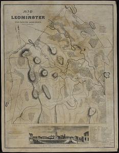
Map of Leominster containing 16602 acres
3655.
Map of Liberia
3656.
A map of Long Island
3657.
A map of Louisiana and of the River Mississipi
3658.
Map of Louisiana, Mississippi and Alabama : constructed from the latest authorities
3659.
Map of Lunenburg
3660.
Map of Lynn and Saugus : settled in 1629
‹ Prev
Next ›
1
2
…
179
180
181
182
183
184
185
186
187
…
434
435