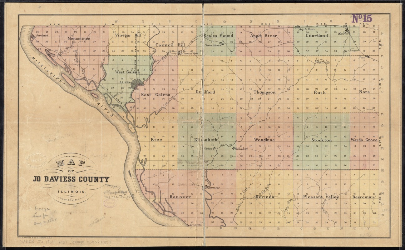
Map of Jo Daviess County, Illinois
Item Information
- Title:
- Map of Jo Daviess County, Illinois
- Date:
-
[1860–1864]
- Format:
-
Maps/Atlases
- Location:
-
Boston Public Library
Norman B. Leventhal Map & Education Center - Collection (local):
-
Norman B. Leventhal Map & Education Center Collection
- Subjects:
-
Jo Daviess County (Ill.)--Maps
- Places:
-
IllinoisJo Daviess (county)
- Extent:
- 1 map : hand col. ; 34 x 57 cm.
- Terms of Use:
-
No known copyright restrictions.
No known restrictions on use.
- Publisher:
-
New York :
Lith. of Endicott & Co.
- Scale:
-
Scale [ca. 1:110,000]
- Language:
-
English
- Notes:
-
Shows townships and public land survey sections.
- Notes (date):
-
This date is inferred.
- Identifier:
-
06_01_011333
- Call #:
-
G4103.J6 1864 .M37
- Barcode:
-
39999065684977


