Toggle navigation
LMEC Home
Exhibitions
Georeferencing
Tools for Teachers
Collections
My Favorites
Sign Up / Log In
Search
Search the map portal
Map Collection
Map Collection
Map Sets
Search
Search
Search for
Search In
All Fields
Creator
Title
Subject
Place
Search All Digital Collections
Advanced Search
334 Results
My Search
Start Over
More Like
commonwealth:j38608818
Remove constraint More Like: commonwealth:j38608818
Filter your Search
Place
North and Central America
291
United States
272
Massachusetts
242
Rhode Island
54
Suffolk (county)
43
Boston
42
New England
31
Connecticut
28
more
Place
»
Topic
Massachusetts--Maps
235
Rhode Island--Maps
50
Boston (Mass.)--Maps
46
Railroads--Massachusetts--Maps
32
Connecticut--Maps
25
Roads--Massachusetts--Maps
19
New England--Maps
16
New England--Maps--Early works to 1800
15
more
Topic
»
Date
Date range begin
–
Date range end
Current results range from
1482
to
2020
View distribution
Creator
MassGIS (Office : Mass.)
20
Geo. H. Walker & Co
15
Massachusetts. Executive Office of Environmental Affairs
14
Boston Public Library. Norman B. Leventhal Map and Education Center
9
Geological Survey (U.S.)
8
Applied Geographics, Inc.
7
Carleton, Osgood, 1742-1816
7
Carey, Mathew, 1760-1839
6
more
Creator
»
Format
Maps/Atlases
332
Manuscripts
3
Books
1
Ephemera
1
Prints
1
Georeferenced
Yes
67
No
267
Collection
Norman B. Leventhal Map & Education Center Collection
220
Boston and New England Maps
183
Sidney R. Knafel Map Collection at Phillips Academy
87
American Revolutionary War-Era Maps
50
Applied Geographics, Inc. Records
20
David Judkins Weaver Papers
18
Urban Maps
11
William L. Clements Library Collection
10
more
Collection
»
Available to use
No known restrictions
212
Creative Commons license
12
Search Constraints
Sort by relevance
relevance
title
date (asc)
date (desc)
Number of results to display per page
20 per page
10
per page
20
per page
50
per page
100
per page
View results as:
grid view
map view
Search Results
181.
Massachusetts coastal watersheds
182.
Massachusetts coastal zone management
183.
Massachusetts coastal zone management program : volume 1, summary map
184.
Massachusetts CZM shoreline change analysis project
185.
Massachusetts drainage basins
186.
Massachusetts highway program for 1965
187.
The Massachusetts interstate highway program
188.
Massachusetts land use - 1985
189.
Massachusetts land use - 1985
190.
Massachusetts navigation and dredging management study
191.
Massachusetts official transportation map
192.
Massachusetts official transportation map
193.
Massachusetts open space and recreation facilities
194.
Massachusetts orthophoto basemap sheet index
195.
Massachusetts orthophoto basemap sheet index
196.
Massachusetts outdoor recreation plan 1966 : public outdoor recreation areas
197.
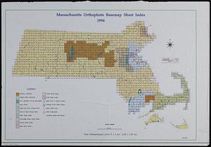
Massachusetts river basins
198.
Massachusetts river basins
199.
Massachusetts tourists map : showing tourways, picnic sites, beaches, and camp grounds
200.
Massachusetts Turnpike map : the main street of Massachusetts
‹ Prev
Next ›
1
2
…
6
7
8
9
10
11
12
13
14
…
16
17