Toggle navigation
LMEC Home
Exhibitions
Georeferencing
Tools for Teachers
Collections
My Favorites
Sign Up / Log In
Search
Search the map portal
Map Collection
Map Collection
Map Sets
Search
Search
Search for
Search In
All Fields
Creator
Title
Subject
Place
Search All Digital Collections
Advanced Search
151 Results
My Search
Start Over
More Like
commonwealth:j3860851j
Remove constraint More Like: commonwealth:j3860851j
Filter your Search
Place
World
64
North and Central America
46
New England
20
United States
17
Massachusetts
16
Rhode Island
8
New York
7
Connecticut
6
more
Place
»
Topic
World maps--Early works to 1800
76
New England--Maps--Early works to 1800
15
America--Maps--Early works to 1800
11
Massachusetts--Maps
8
North America--Maps--Early works to 1800
8
Western Hemisphere--Maps--Early works to 1800
8
Connecticut--Maps--Early works to 1800
5
Cook, James, 1728-1779
5
more
Topic
»
Date
Date range begin
–
Date range end
Current results range from
1482
to
1990
View distribution
Creator
Ortelius, Abraham, 1527-1598
6
Mercator, Gerhard, 1512-1594
5
Bordon, Benedetto, 1450-1530
4
Münster, Sebastian, 1489-1552
4
Bew, John, -1793
3
Carey, Mathew, 1760-1839
3
Hondius, Hendrik, 1597-1651
3
Hondius, Jodocus, 1594 or 1595-1629
3
more
Creator
»
Format
Maps/Atlases
151
Manuscripts
2
Books
1
Georeferenced
Yes
10
No
141
Collection
Sidney R. Knafel Map Collection at Phillips Academy
87
Norman B. Leventhal Map Center Collection
64
American Revolutionary War-Era Maps
29
Mapping Boston Collection
19
Available to use
No known restrictions
45
Creative Commons license
19
Search Constraints
Sort by date (desc)
relevance
title
date (asc)
date (desc)
Number of results to display per page
20 per page
10
per page
20
per page
50
per page
100
per page
View results as:
grid view
map view
Search Results
61.
A map of the world : corrected from the observations communicated to the Royal Societys of London and Paris
62.
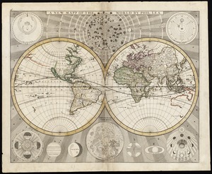
A new map of the world from the latest observations
63.
A new & correct map of the whole world : shewing ye situation of its principal parts. viz. the oceans, kingdoms, rivers, capes,...
64.
Mappmonde ou description generale du globe terrestre
65.
New England and New York
66.
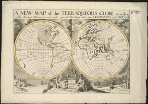
A new map of the terraqueous globe according to the ancient discoveries and most general divisions of it into continents and...
67.
A new map of the terraqueous globe according to the latest discoveries and most general divisions of it into continents and oceans
68.
[Hamadaradz Asharhatsuyts] = [Extensive world map]
69.
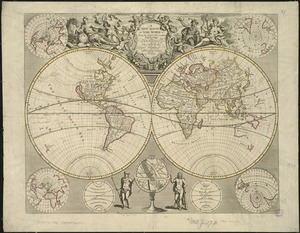
Nouus planiglobii terrestris per utrumque polum conspectus
70.
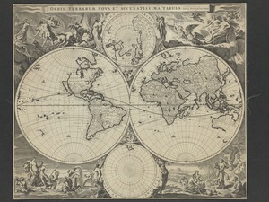
Orbis terrarum nova et accuratissima tabula
71.
Nouvelle Angleterre et Nouvel York
72.
Pas-caert van Nieu Nederland, Virginia, Nieu Engeland als mede Penn-silvania, met de stad Philadelfia van Baston tot Carrik = a...
73.
A new mapp of the world
74.
New England and New York
75.
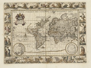
Nova totius terrarum orbis geographica ac hydrographica tabula
76.
A map of New-England, being the first that ever was here cut, and done by the best pattern that could be had, which being in...
77.
Pascaert van Nieu Nederland van Hendrick Christiaens Eijland tot staten hoeck of Cabo Cod
78.
Costes et rivieres de Virginie, de Mariland, et de Nouvelle Angletere
79.
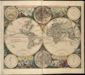
Novissima totius terrarum orbis tabula
80.
Orbis terrarum nova et accuratissima tabula
‹ Prev
Next ›
1
2
3
4
5
6
7
8


![[Hamadaradz Asharhatsuyts]](https://bpldcassets.blob.core.windows.net/derivatives/images/commonwealth:x633f982n/image_thumbnail_300.jpg)