Toggle navigation
LMEC Home
Exhibitions
Georeferencing
Tools for Teachers
Collections
My Favorites
Sign Up / Log In
Search
Search the map portal
Map Collection
Map Collection
Map Sets
Search
Search
Search for
Search In
All Fields
Creator
Title
Subject
Place
Search All Digital Collections
Advanced Search
502 Results
My Search
Start Over
More Like
commonwealth:hx11z5595
Remove constraint More Like: commonwealth:hx11z5595
Filter your Search
Place
North and Central America
462
United States
341
New England
129
Canada
115
New York
36
Massachusetts
30
Essex (county)
24
Suffolk (county)
22
more
Place
»
Topic
New England--Maps
127
United States--History--French and Indian War, 1754-1763--Maps, Manuscript--Early works to 1800
58
Railroads--New England--Maps
50
New York (State)--Maps
20
Louisbourg (N.S.)--Maps, Manuscript--Early works to 1800
18
Fort Edward (N.Y.)--Maps, Manuscript--Early works to 1800
16
Fort Ticonderoga (N.Y.)--Maps, Manuscript--Early works to 1800
15
Saint Lawrence River--Maps, Manuscript--Early works to 1800
15
more
Topic
»
Date
Date range begin
–
Date range end
Current results range from
1664
to
2015
View distribution
Creator
Royal United Services Institute for Defence and Security Studies
160
George, III, King of Great Britain, 1738-1820
152
George, IV, King of Great Britain, 1762-1830
151
Amherst, Jeffery Amherst, Baron, 1717-1797
128
Skinner, Monier
28
Skinner, William, 1700-1780
28
Brasier, William
16
Bastide, John Henry, approximately 1700-1770
15
more
Creator
»
Format
Maps/Atlases
485
Manuscripts
151
Drawings/Illustrations
15
Georeferenced
Yes
26
No
476
Collection
British Library Collection
376
American Revolutionary War-Era Maps
368
Norman B. Leventhal Map & Education Center Collection
106
Boston and New England Maps
96
Maps from AAS
9
Urban Maps
6
David Judkins Weaver Papers
4
Sidney R. Knafel Map Collection at Phillips Academy
4
more
Collection
»
Available to use
Creative Commons license
377
No known restrictions
106
Search Constraints
Sort by relevance
relevance
title
date (asc)
date (desc)
Number of results to display per page
20 per page
10
per page
20
per page
50
per page
100
per page
View results as:
grid view
map view
Search Results
361.
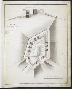
PLAN of the Bastion at Fort George
362.
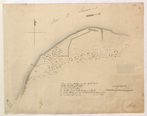
Plan of the Battery on the South Shore Erected against Fort Levy on the 21. of August 1760
363.
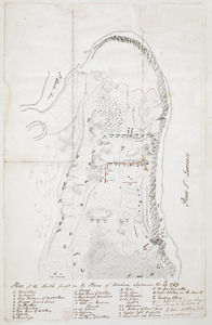
Plan of the Battle fought on the Plains of Abraham, September the 13th 1759
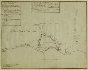
364.
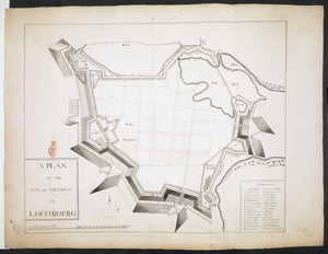
A PLAN OF THE CITY and FORTRESS OF LOUISBOURG
365.
Plan of the City and Fortress of LOUISBOURG Surrendered to his Britanick Majesty by Capitulation the 17 June 1745. to Lieut....
366.
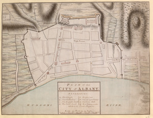
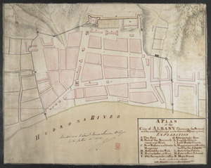
PLAN of the CITY of ALBANY
367.
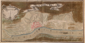
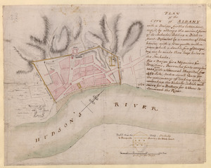
PLAN, of the CITY, of ALBANY, in the PROVINCE, of, NEW, YORK
368.
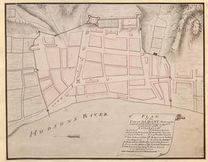
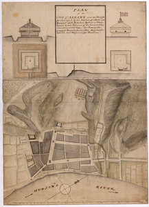
PLAN of the City of ALBANY Shewing the Several works & Buildings made there in the Years 1756 & 57
369.
A PLAN of the City of ALBANY Shewing the Several works and Buildings made there in the Year 1756 & 57
370.
PLAN of the CITY of ALBANY with a Design for the better securing it, by altering the ancient form of its Stockade; Adding a...
371.
PLAN of the CITY of ALBANY with the Designs for Securing it by the Addition of a Ditch, and Rampart; with Detached Redouts or...
372.
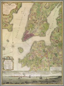
PLAN of the CITY of NEW YORK, in North America : Surveyed in the Years 1766 & 1767
373.
Plan of the communication from Fort Cumberland to Presqu'Isle
374.
PLAN of the COMMUNICATION from TOWNSHIP No 8 to CATARAQUI as Surveyed by M.r Louis Kott Dep.t Prov.l Surv
375.
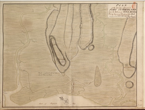
PLAN of the Country adjacent to FORT CUMBERLAND Upon the Isthmus of NOVA-SCOTIA Showing the general Situation of that Fort
376.
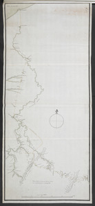
PLAN of the COUNTRY from FORT EDWARD to CROWN POINT
377.
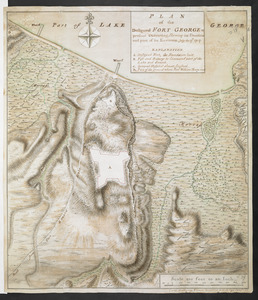
PLAN of the Designed FORT GEORGE at present executing, Shewing its situation and part of its Environs. July the 17.th 1759
378.
PLAN of the Encampement at Lake George the 27th Iuin 1759
379.
PLAN of the Encampment Intrenchment with thier Environs at LAKE GEORGE
380.
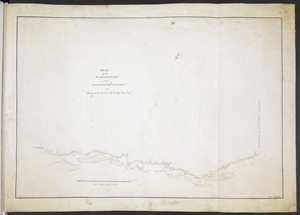
PLAN OF THE ENCAMPMENT OF THE ARMY AT LAKE GEORGE JUNE 1759
‹ Prev
Next ›
1
2
…
15
16
17
18
19
20
21
22
23
…
25
26