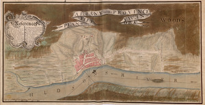
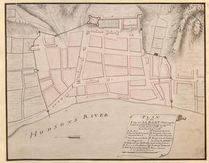
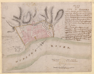
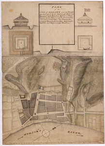
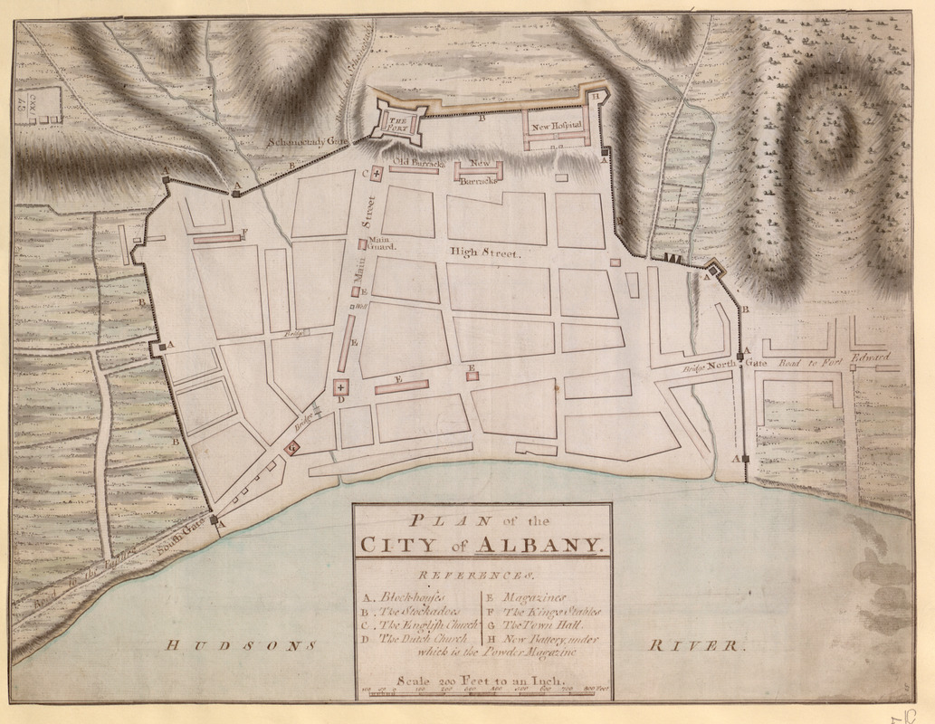
PLAN of the CITY of ALBANY
This map is also available in American Revolutionary Geographies Online (ARGO), a collections portal especially built for material relating to the American Revolutionary War Era. Visit ARGO to learn more about this item and explore the historical geography of North America in the late eighteenth century.
Item Information
- Title:
- PLAN of the CITY of ALBANY
- Former owner:
- George, III, King of Great Britain, 1738-1820
- Donor:
- George, IV, King of Great Britain, 1762-1830
- Date:
-
1757
- Format:
-
Maps/Atlases
Manuscripts
- Location:
- British Library
- Collection (local):
-
British Library Collection
- Subjects:
-
Fortification--New York (State)--Albany--Maps, Manuscript--Early works to 1800
Military art and science--New York (State)--Albany--Maps, Manuscript--Early works to 1800
Albany (N.Y.)--Maps, Manuscript--Early works to 1800
Fort Albany (N.Y.)--Maps, Manuscript--Early works to 1800
United States--History--French and Indian War, 1754-1763--Maps, Manuscript--Early works to 1800
- Places:
-
Albany (county)Albany
Fort Frederick (historical)
- Extent:
- 1 map ; manuscript pen and ink with watercolour ; 35 x 46 cm
- Terms of Use:
-
No known copyright restrictions.
This work is licensed for use under a Creative Commons Attribution Non-Commercial Share Alike License (CC BY-NC-SA).

- Scale:
-
Scale approximately 1:2,400
- Language:
-
English
- Catalog Record:
-
http://explore.bl.uk/BLVU1:LSCOP-ALL:BLL01016739247
- Notes:
-
Relief is shown by shading.
The title appears in a simple surround with a lettered list of references (A to H) identifying locations within Albany.
The fort, the new hospital, the old and new barracks, High Street and Main Street are named on the map.
A "Scale 200 feet to an Inch" also appears within the title.
Titled "A drawn Plan of the City of Albany" in the Catalogue of Maps, Prints, Drawings, etc., forming the geographical and topographical collection attached to the Library of his late Majesty King George the third, etc., London, 1829.
Titled 'A colored "plan of the city of Albany, shewing the several works and buildings made there in the years 1756 and 57;" drawn on a scale of 200 feet to an inch; 1 f. 5 in. x 1 f. 1 1/2 in. Two copies' in the Catalogue of the manuscript maps, charts, and plans, and of the topographical drawings in the British Museum. [the "two copies" listed here are two separate manuscript maps in different hands now catalogued separately - see Maps K.Top.121.42.]