Toggle navigation
LMEC Home
Exhibitions
Georeferencing
Tools for Teachers
Collections
My Favorites
Sign Up / Log In
Search
Search the map portal
Map Collection
Map Collection
Map Sets
Search
Search
Search for
Search In
All Fields
Creator
Title
Subject
Place
Search All Digital Collections
Advanced Search
207 Results
My Search
Start Over
More Like
commonwealth:hq37vv96j
Remove constraint More Like: commonwealth:hq37vv96j
Filter your Search
Place
North and Central America
164
United States
143
New England
100
Northeastern United States
42
Canada
27
Massachusetts
27
Middle Atlantic
23
New York
20
more
Place
»
Topic
New England--Maps--Early works to 1800
97
Northeastern States--Maps--Early works to 1800
46
Middle Atlantic States--Maps--Early works to 1800
22
Canada--Maps--Early works to 1800
14
North America--Maps--Early works to 1800
13
World maps--Early works to 1800
13
New York (State)--Maps--Early works to 1800
12
Massachusetts--Maps--Early works to 1800
10
more
Topic
»
Date
Date range begin
–
Date range end
Current results range from
1482
to
1999
View distribution
Creator
Jefferys, Thomas, -1771
8
Jefferys, Thomas, d. 1771
8
Bellin, Jacques Nicolas, 1703-1772
7
Bowles, Carington, 1724-1793
7
Evans, Lewis, 1700?-1756
6
Ortelius, Abraham, 1527-1598
5
Bowles, John, 1701-1779
4
Green, John, d. 1757
4
more
Creator
»
Format
Maps/Atlases
207
Manuscripts
2
Books
1
Georeferenced
Yes
17
No
190
Collection
American Revolutionary War-Era Maps
100
Sidney R. Knafel Map Collection at Phillips Academy
87
Norman B. Leventhal Map & Education Center Collection
78
Boston and New England Maps
30
Mapping Boston Collection
28
MacLean Collection Map Library
15
Maritime Charts and Atlases
13
New York Public Library Collection
11
more
Collection
»
Available to use
No known restrictions
53
Creative Commons license
50
Search Constraints
Sort by relevance
relevance
title
date (asc)
date (desc)
Number of results to display per page
20 per page
10
per page
20
per page
50
per page
100
per page
View results as:
grid view
map view
Search Results
41.
Karte von Neu England, Neu Yorck und Pensilvanien : sur Allgemeinen historie der reisen
42.
A large draught of New England, New York and Long Island
43.
A map of the middle British colonies in North America : first published by Mr. Lewis Evans, of Philadelphia, in 1755; and since...
44.
A map of the middle British colonies in North America : first published by Mr. Lewis Evans, of Philadelphia, in 1755; and since...
45.
Map of the middle states of America : drawn from the latest and best authorities
46.
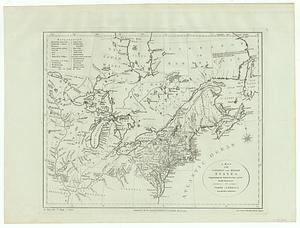
A map of the northern and middle states : comprehending the western territory and the British dominions in North America from...
47.
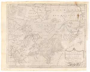
A map of the northern and middle states : comprehending the western territory and the British dominions in North America ;...
48.
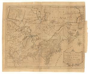
A map of the northern and middle states : comprehending the western territory and the British dominions in North America :...
49.
Map of the northern provinces of the United States
50.
A map of the province of New York, with part of Pensilvania, and New England
51.
A map of the Province of New-York : reduc'd from the large drawing of that province, compiled from actual surveys by order of...
52.
A map of the provinces of New-York and New Jersey, with a part of Pennsylvania and the Province of Quebec
53.
Mappa geographica Provinciæ Nova Eboraci ab Anglis New-York : dictæ ex ampliori delineatione ad exactas dimensiones concinnata...
54.
A new and accurate map of New Jersey, Pensilvania, New York and New England : with the adjacent countries. Drawn from surveys,...
55.
A New and correct map of the British colonies in North America comprehending eastern Canada with the province of Quebec, New...
56.
A new and correct map of the provinces of New England, New York, Canada or New France
57.
Nova Anglia Septentrionali Americae implantata Anglorumque coloniis florentissima geographicè exhibita
58.
Part of North America : comprehending the course of Ohio, New England, New York, New Jersey, Pennsylvania, Maryland, Virginia,...
59.
Partie occidentale de la Virginie, Pensylvanie, Maryland, et Caroline septle. la Rivière d'Ohio, et toutes celles qui s'y...
60.
The provinces of New York and New Jersey : with part of Pensilvania, and the Province of Quebec
‹ Prev
Next ›
1
2
3
4
5
6
7
…
10
11