Toggle navigation
LMEC Home
Exhibitions
Georeferencing
Tools for Teachers
Collections
My Favorites
Sign Up / Log In
Search
Search the map portal
Map Collection
Map Collection
Map Sets
Search
Search
Search for
Search In
All Fields
Creator
Title
Subject
Place
Search All Digital Collections
Advanced Search
395 Results
My Search
Start Over
More Like
commonwealth:h989xm80h
Remove constraint More Like: commonwealth:h989xm80h
Filter your Search
Place
North and Central America
343
United States
216
North America
73
Canada
63
New York
24
Pennsylvania
19
Asia
17
Great Lakes Region
16
more
Place
»
Topic
North America--Maps--Early works to 1800
64
United States--Maps--Early works to 1800
44
Canada--Maps--Early works to 1800
42
Great Lakes Region (North America)--Maps--Early works to 1800
17
Indians of North America--Maps--Early works to 1800
14
Pennsylvania--Maps--Early works to 1800
12
Northeastern States--Maps--Early works to 1800
10
New York (State)--Maps--Early works to 1800
9
more
Topic
»
Date
Date range begin
–
Date range end
Current results range from
1623
to
1999
View distribution
Creator
Jefferys, Thomas, -1771
20
Bellin, Jacques Nicolas, 1703-1772
15
Gibson, J. (John), active 1750-1792
14
Robert Sayer and John Bennett (Firm)
14
Carleton, Osgood, 1742-1816
13
Faden, William, 1749-1836
13
Sayer, Robert, 1725-1794
12
Bowles, Carington, 1724-1793
10
more
Creator
»
Format
Maps/Atlases
393
Manuscripts
5
Paintings
3
Ephemera
1
Objects/Artifacts
1
Prints
1
Georeferenced
Yes
1
No
394
Collection
MacLean Collection Map Library
379
American Revolutionary War-Era Maps
339
Norman B. Leventhal Map & Education Center Collection
7
Richard H. Brown Revolutionary War Map Collection at Mount Vernon
4
Newberry Library Collection
2
Mapping Boston Collection
1
Massachusetts Historical Society Map Collection
1
New York Public Library Collection
1
more
Collection
»
Available to use
Creative Commons license
7
No known restrictions
7
Search Constraints
Sort by relevance
relevance
title
date (asc)
date (desc)
Number of results to display per page
20 per page
10
per page
20
per page
50
per page
100
per page
View results as:
grid view
map view
Search Results
21.
La Pensilvania, la Nuova York, il Jersey Settentrio[na]le : con la parte occidentale del Connecticut, Massachusset-s-bay e...
22.
L'Amerique Septentrionale
23.
Carte du Canada ou de la Nouvelle France et des decouvertes qui y ont été faites
24.
Carte generale des colonies angloises dans l'Amerique Septentrionale pour l'intelligence de la guerre presente : d'apres des...
25.
Copy of a map presented to the Congres [sic]
26.
Cours de l'Ohio depuis sa source jusqu'a sa jonction avec la Riviere d'Ouabache et les pais voisons
27.
Florida from the latest authorities
28.
A general map of the middle British colonies in America : viz. Virginia, Maryland, Delaware, Pensilvania, New-Jersey, New-York,...
29.
Karte von Neu England, Neu Yorck und Pensilvanien
30.
A map of the British and French dominions in North America : with the roads, distances, limits, and extent of the settlements,...
31.
Theodolite's pattern, shewing the provinces in North America which were in the respective possessions of England, France &...
32.
1.st sheet of De Witt's state-map of New-York
33.
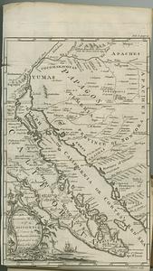
An accurate map of California drawn by the society of Jesuits, & dedicated to the king of Spain
34.
An accurate map of His Majesty's province of New Hampshire in New England, taken from actual surveys of all the inhabited part,...
35.
An accurate map of North America describing and distinguishing the British, Spanish and French dominions on this great...
36.
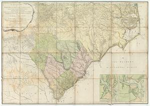
An accurate map of North and South Carolina with their Indian frontiers : shewing in a distinct manner all the mountains,...
37.
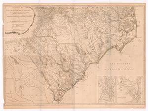
An accurate map of North and South Carolina with their Indian frontiers, shewing in a distinct manner all the mountains,...
38.
An accurate map of the commonwealth of Massachusetts exclusive of the district of Maine compiled pursuant to an act of the...
39.
An accurate map of the commonwealth of Massachusetts exclusive of the district of Maine compiled pursuant to an act of the...
40.
An accurate map, of the district of Maine being part of the commonwealth of Massachusetts : compiled pursuant to an act of the...
‹ Prev
Next ›
1
2
3
4
5
6
…
19
20
![La Pensilvania, la Nuova York, il Jersey Settentrio[na]le](https://bpldcassets.blob.core.windows.net/derivatives/images/commonwealth:z603vq53g/image_thumbnail_300.jpg)


![Copy of a map presented to the Congres [sic]](https://bpldcassets.blob.core.windows.net/derivatives/images/commonwealth:z603vn16x/image_thumbnail_300.jpg)