Toggle navigation
LMEC Home
Exhibitions
Georeferencing
Tools for Teachers
Collections
My Favorites
Sign Up / Log In
Search
Search the map portal
Map Collection
Map Collection
Map Sets
Search
Search
Search for
Search In
All Fields
Creator
Title
Subject
Place
Search All Digital Collections
Advanced Search
857 Results
My Search
Start Over
More Like
commonwealth:d7920269f
Remove constraint More Like: commonwealth:d7920269f
Filter your Search
Place
North and Central America
804
United States
647
New York
131
New England
130
Canada
86
New Jersey
80
North America
69
Massachusetts
52
more
Place
»
Topic
United States--History--Revolution, 1775-1783--Maps
330
New England--Maps
127
North America--Maps--Early works to 1800
59
Railroads--New England--Maps
50
United States--Maps--Early works to 1800
44
New Jersey--Maps
40
Canada--Maps--Early works to 1800
38
New York (State)--Maps
35
more
Topic
»
Date
Date range begin
–
Date range end
Current results range from
1623
to
2015
View distribution
Creator
Faden, William, 1749-1836
21
Robert Sayer and John Bennett (Firm)
19
Jefferys, Thomas, -1771
18
Clinton, Henry, Sir, 1738?-1795
17
Bellin, Jacques Nicolas, 1703-1772
16
Gibson, J. (John), active 1750-1792
14
Hills, John, active 1777-1819
14
Montrésor, John, 1736-1799
14
more
Creator
»
Format
Maps/Atlases
850
Manuscripts
9
Drawings/Illustrations
5
Paintings
3
Ephemera
1
Objects/Artifacts
1
Prints
1
Georeferenced
Yes
35
No
822
Collection
American Revolutionary War-Era Maps
673
MacLean Collection Map Library
379
William L. Clements Library Collection
310
Norman B. Leventhal Map & Education Center Collection
132
Boston and New England Maps
83
Maps from AAS
19
David Judkins Weaver Papers
4
Sidney R. Knafel Map Collection at Phillips Academy
4
more
Collection
»
Available to use
No known restrictions
134
Creative Commons license
8
Search Constraints
Sort by relevance
relevance
title
date (asc)
date (desc)
Number of results to display per page
20 per page
10
per page
20
per page
50
per page
100
per page
View results as:
grid view
map view
Search Results
601.
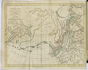
A general map of the discoveries of Admiral de Fonte, exhibiting the great probability of a north-west passage
602.
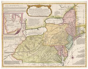
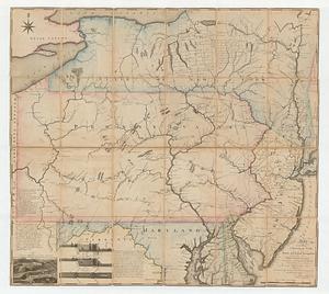
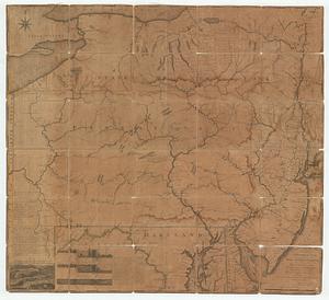
A general map of the Middle British Colonies, in America: viz Virginia, Mariland, Delaware, Pensilvania, New-Jersey, New-York,...
603.
A general map of the Middle British Colonies in America viz. Virginia, Maryland, Delaware, Pensilvania, New-Jersey New York,...
604.
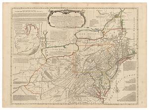
A general map of the Middle British Colonies in America viz. Virginia, Maryland, Delaware, Pensilvania, New-Jersey New York,...
605.
A general map of the Middle British Colonies in America viz. Virginia, Maryland, Delaware, Pensilvania, of Aquanishuonigy the...
606.
A general map of the Middle British Colonies in America viz. Virginia, Maryland, Delaware, Pensilvania, of Aquanishuonigy the...
607.
A general map of the world, or terraqueous globe : with all the new discoveries and marginal delineations, containing the most...
608.
Generalkarte von Nordamerika samt den Westindischen Inseln
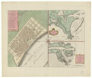
609.
Grondvlakte van Nieuw Orleans, de hoofdstad van Louisiana ; de uitloop van de Rivier Missisippi ; de oostelyke ingang van de...
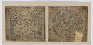
610.
Haejwa do
611.
Joseon yojido
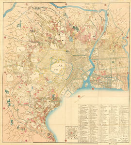
612.
Kaisei On’edo oezu
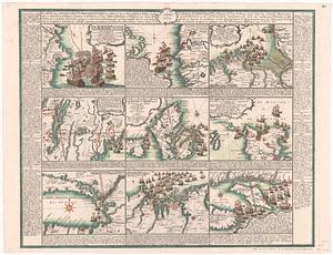
613.
Karte derer englischen unternehmungen zur zee aus denen franzosischen kusten ... = Carte des entrep: anglo:ises par mer sur les...
614.
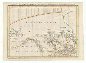
Karte des nordens von America, zur beurtheilung der wahrscheinlichkeit einer north=westlichen durchfahrt
615.
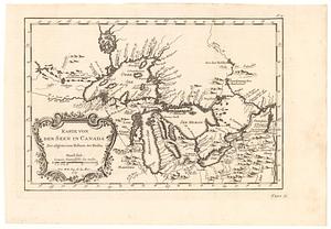
Karte von den seen in Canada zur allgemeinen historie der reisen
616.
Karte von Luisiana, dem laufe des Mississipi und den benachbaerten laendern
617.
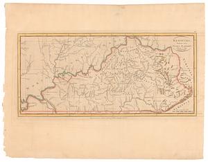
Kentucky, reduced from Elihu Barker's large map
618.
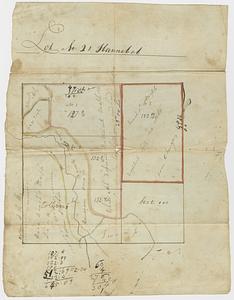
Lot no. 21 Hannibal
619.
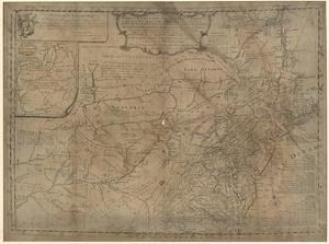
A map exhibiting a general view of the roads and inland navigation of Pennsylvania, and part of the adjacent states :...
620.
A map exhibiting a general view of the roads and inland navigation of Pennsylvania, and part of the adjacent states :...
‹ Prev
Next ›
1
2
…
27
28
29
30
31
32
33
34
35
…
42
43