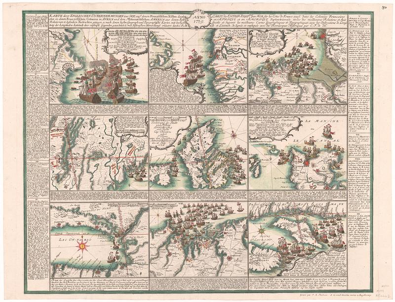
Karte derer englischen unternehmungen zur zee aus denen franzosischen kusten ... = Carte des entrep: anglo:ises par mer sur les cotes de France ...
This map is also available in American Revolutionary Geographies Online (ARGO), a collections portal especially built for material relating to the American Revolutionary War Era. Visit ARGO to learn more about this item and explore the historical geography of North America in the late eighteenth century.
Item Information
- Title:
- Karte derer englischen unternehmungen zur zee aus denen franzosischen kusten ... = Carte des entrep: anglo:ises par mer sur les cotes de France ...
- Contributor:
- Heyden, Christian Friederich van der
- Publisher:
- Fridrich, Jacob Andreas, 1714-1779
- Name on Item:
-
erlautert durch C.F. v. H.
- Date:
-
1759
- Format:
-
Maps/Atlases
- Location:
- MacLean Collection Map Library
- Collection (local):
-
MacLean Collection Map Library
- Subjects:
-
Great Britain--Colonies--Maps
Anglo-French War, 1755-1763--Maps--Early works to 1800
United States--History--French and Indian War, 1754-1763--Maps
Naval battles--Europe--Maps--Early works to 1800
Naval battles--North America--Maps--Early works to 1800
- Places:
-
North America (area)
Europe
Africa
- Extent:
- 1 map ; 560 x 690 mm
- Terms of Use:
-
Public Domain/No known restrictions on use. Contact host institution to download image.
Contact host institution for more information.
- Publisher:
-
Augsburg :
Frederic, Jacob Andreas
- Edition:
- First state
- Language:
-
German
French
- Notes:
-
"Grave par J.A. Frederic, et se vend chez lui meme a Augsbourg."
- Identifier:
-
MC_12750
- Call #:
-
12750


