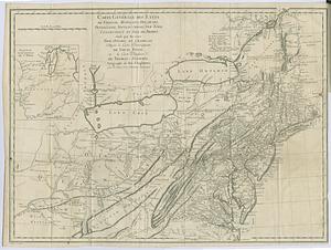
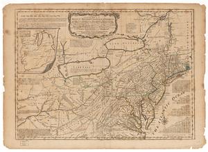
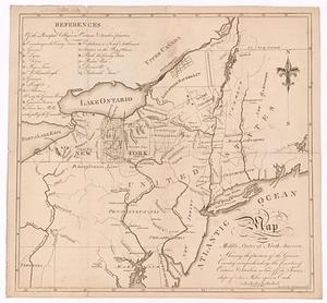
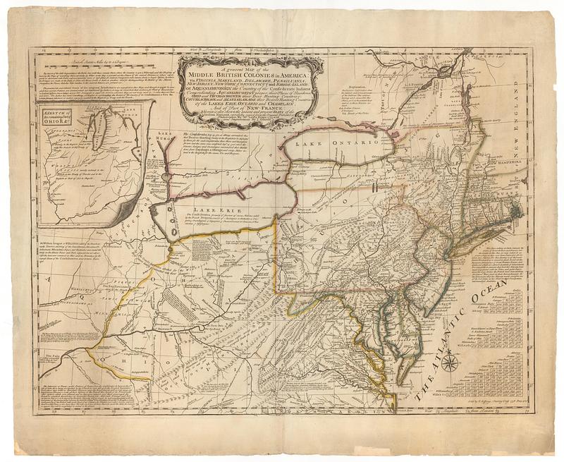
A general map of the Middle British Colonies in America viz. Virginia, Maryland, Delaware, Pensilvania, of Aquanishuonigy the country of the confederate Indians comprehending Aquanishuonigy proper, their places of residence, Ohio and Thuchsochruntie their deer hunting countries, Couchsachrage and Skaniadarade their beaver hunting countries, of the lakes Erie, Ontario and Champlain, and of part of New-France: wherein is also shewn the antient and present seats of the Indian nations
This map is also available in American Revolutionary Geographies Online (ARGO), a collections portal especially built for material relating to the American Revolutionary War Era. Visit ARGO to learn more about this item and explore the historical geography of North America in the late eighteenth century.
Item Information
- Title:
- A general map of the Middle British Colonies in America viz. Virginia, Maryland, Delaware, Pensilvania, of Aquanishuonigy the country of the confederate Indians comprehending Aquanishuonigy proper, their places of residence, Ohio and Thuchsochruntie their deer hunting countries, Couchsachrage and Skaniadarade their beaver hunting countries, of the lakes Erie, Ontario and Champlain, and of part of New-France: wherein is also shewn the antient and present seats of the Indian nations
- Contributor:
- Gibson, J. (John), active 1750-1792
- Publisher:
- Evans, Lewis, 1700?-1756
- Name on Item:
-
carefully copied from the original publish'd at Philadelphia by Mr. Lewis Evans 1755, with some improvements by I. Gibson
- Date:
-
1758
- Format:
-
Maps/Atlases
- Location:
- MacLean Collection Map Library
- Collection (local):
-
MacLean Collection Map Library
- Subjects:
-
Middle Atlantic States--Maps
Pownall, Thomas, 1722-1805
- Places:
-
Middle Atlantic (area)
- Extent:
- 1 map ; 490 x 65 mm
- Terms of Use:
-
Public Domain/No known restrictions on use. Contact host institution to download image.
Contact host institution for more information.
- Publisher:
-
London :
Evans, Lewis
- Language:
-
English
- Identifier:
-
MC_26906
- Call #:
-
26906