Toggle navigation
LMEC Home
Exhibitions
Georeferencing
Tools for Teachers
Collections
My Favorites
Sign Up / Log In
Search
Search the map portal
Map Collection
Map Collection
Map Sets
Search
Search
Search for
Search In
All Fields
Creator
Title
Subject
Place
Search All Digital Collections
Advanced Search
8761 Results
My Search
Start Over
More Like
commonwealth:cj82m3590
Remove constraint More Like: commonwealth:cj82m3590
Filter your Search
Place
North and Central America
5,991
United States
4,909
Massachusetts
2,083
Europe
1,396
Suffolk (county)
1,046
Boston
1,019
Canada
459
Asia
438
more
Place
»
Topic
Boston (Mass.)--Maps
586
United States--Maps
282
Real property--Massachusetts--Boston--Maps
175
Massachusetts--Maps
162
Landowners--Massachusetts--Boston--Maps
133
North America--Maps--Early works to 1800
106
New England--Maps
102
New England--Maps--Early works to 1800
97
more
Topic
»
Date
Date range begin
–
Date range end
Current results range from
1482
to
2023
View distribution
Creator
United States. Hydrographic Office
595
O.H. Bailey & Co
148
Des Barres, Joseph F. W. (Joseph Frederick Wallet), 1722-1824
124
United States. Post Office Dept
120
Ptolemy, 2nd cent
100
Walling, Henry Francis, 1825-1888
94
Jefferys, Thomas, -1771
88
Geological Survey (U.S.)
86
more
Creator
»
Format
Maps/Atlases
8,701
Manuscripts
216
Prints
56
Books
36
Objects/Artifacts
10
Drawings/Illustrations
8
Posters
5
Georeferenced
Yes
874
No
7,887
Collection
Norman B. Leventhal Map & Education Center Collection
8,721
Boston and New England Maps
2,244
Urban Maps
2,023
Maritime Charts and Atlases
1,087
American Revolutionary War-Era Maps
650
Boston Redevelopment Authority Collection
87
Mapping Boston Collection
25
Sidney R. Knafel Map Collection at Phillips Academy
17
more
Collection
»
Available to use
No known restrictions
8,555
Creative Commons license
86
Search Constraints
Sort by relevance
relevance
title
date (asc)
date (desc)
Number of results to display per page
20 per page
10
per page
20
per page
50
per page
100
per page
View results as:
grid view
map view
Search Results
1841.
Commercial map of New England
1842.
Commercial map of the Near East
1843.
The common school atlas : drawn and engraved on steel : to illustrate and accompany The introduction to modern geography [cover]
1844.
The Commonwealth of Connecticut
1845.
Communications entre l'Angleterre, l'Allemagne, et la France, par les chemins de fer Belges
1846.
Comparative map of Cape Cod Harbor showing physical changes between the survey of Maj. J.D. Graham in 1835, and the U.S. Coast...
1847.
Comparative map of distances between Paris & Cologne, and likewise between Dover and Cologne
1848.
Comparative map of distances between Paris & Cologne, and likewise between Dover and Cologne
1849.
Comparative view of the heights of the principal mountains &c. in the world
1850.
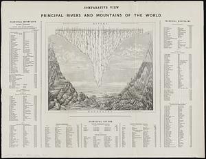
Comparative view of the principal rivers and mountains of the world
1851.
Compiled plan, showing Millers Creek and a portion of Charles River
1852.
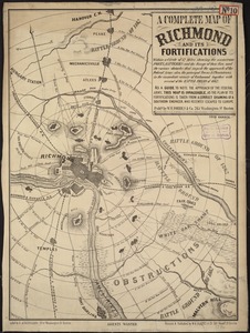
A complete map of Richmond and its fortifications within a circle of 12 miles showing the numerous forts, batteries and the...
1853.
Complete map of the rail roads and water courses in the United States & Canada
1854.
Complete map of Vermont showing highways & natural features with an index of all cities, villages, post-offices and railroad...
1855.
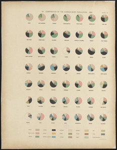
Composition of the foreign-born population : 1890
1856.
A comprehensive atlas geographical, historical & commercial [title page]
1857.
Compromise of 1850, September 6, 1850, vote on passage of Texas-New Mexico provisions
1858.
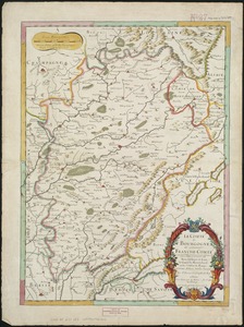
Le comté de Bourgogne, dit autrement Franche-comté conquise par le Roy, en moins de 15 jours de temps, dans le mois de...
1859.
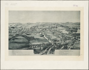
Concord Junction, Mass : 1893
1860.
Connecticut
‹ Prev
Next ›
1
2
…
89
90
91
92
93
94
95
96
97
…
438
439


![A comprehensive atlas geographical, historical & commercial [title page]](https://bpldcassets.blob.core.windows.net/derivatives/images/commonwealth:3f463182f/image_thumbnail_300.jpg)