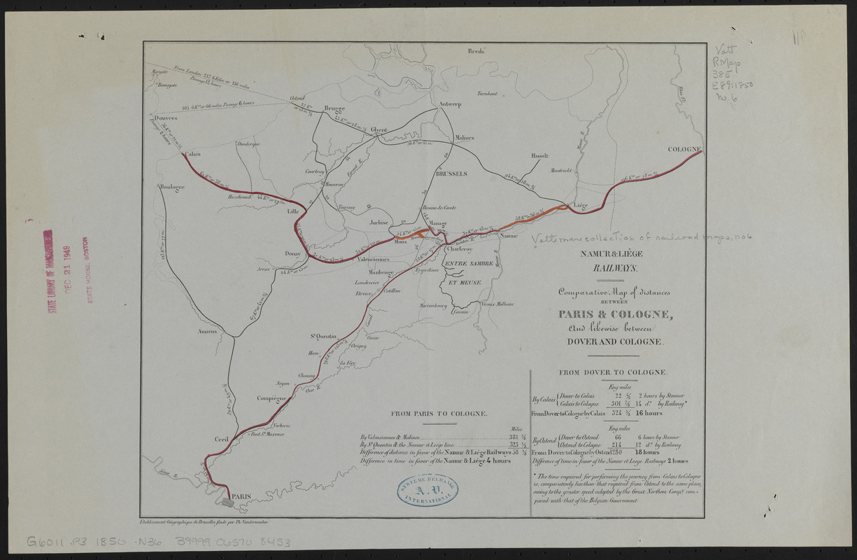
Comparative map of distances between Paris & Cologne, and likewise between Dover and Cologne
Item Information
- Title:
- Comparative map of distances between Paris & Cologne, and likewise between Dover and Cologne
- Cartographer:
- Namur and Liége Railways
- Publisher:
- Etablissement géographique de Bruxelles
- Name on Item:
-
Namur & Liége Railways
- Date:
-
[1850?–1859?]
- Format:
-
Maps/Atlases
- Location:
-
Boston Public Library
Norman B. Leventhal Map & Education Center - Collection (local):
-
Norman B. Leventhal Map & Education Center Collection
- Series:
- Vattemare Collection
- Subjects:
-
Railroads--Belgium--Maps
Railroads--France--Maps
Belgium--Maps
France--Maps
- Places:
-
Belgium
France
- Extent:
- 1 map : color ; 24 x 29 cm
- Terms of Use:
-
No known copyright restrictions.
No known restrictions on use.
- Publisher:
-
Bruxelles :
Etablissement géographique de Bruxelles fondé par Ph. Vandermaelen
- Scale:
-
Scale approximately 1:885,000
- Language:
-
English
- Notes:
-
Includes list of distances.
- Identifier:
-
06_01_014977
- Call #:
-
G6011.P3 1850 .N36
- Barcode:
-
39999065708453