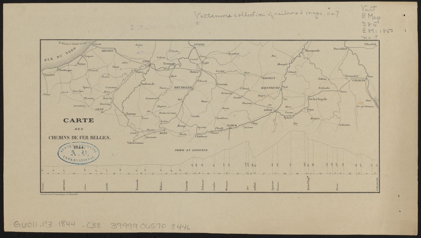
Carte des chemins de fer Belges
Item Information
- Title:
- Carte des chemins de fer Belges
- Name on Item:
-
Etablissement géographique de Bruxelles
- Date:
-
1844
- Format:
-
Maps/Atlases
- Location:
-
Boston Public Library
Norman B. Leventhal Map & Education Center - Collection (local):
-
Norman B. Leventhal Map & Education Center Collection
- Series:
- Vattemare Collection
- Subjects:
-
Railroads--Belgium--Maps
Belgium--Maps
- Places:
-
Belgium
- Extent:
- 1 map ; 12 x 26 cm
- Terms of Use:
-
No known copyright restrictions.
No known restrictions on use.
- Publisher:
-
[Place of publication not identified] :
[Etablissement géographique de Bruxelles]
- Scale:
-
Scale approximately 1:1,360,000
- Language:
-
French
- Notes:
-
Includes Profil en longueur.
- Identifier:
-
06_01_014976
- Call #:
-
G6011.P3 1844 .C38
- Barcode:
-
39999065708446


