Toggle navigation
LMEC Home
Exhibitions
Georeferencing
Tools for Teachers
Collections
My Favorites
Sign Up / Log In
Search
Search the map portal
Map Collection
Map Collection
Map Sets
Search
Search
Search for
Search In
All Fields
Creator
Title
Subject
Place
Search All Digital Collections
Advanced Search
8707 Results
My Search
Start Over
More Like
commonwealth:cj82m296x
Remove constraint More Like: commonwealth:cj82m296x
Filter your Search
Place
North and Central America
5,938
United States
4,856
Massachusetts
2,084
Europe
1,396
Suffolk (county)
1,047
Boston
1,020
Canada
449
Asia
438
more
Place
»
Topic
Boston (Mass.)--Maps
586
United States--Maps
282
Real property--Massachusetts--Boston--Maps
175
Massachusetts--Maps
162
Landowners--Massachusetts--Boston--Maps
133
North America--Maps--Early works to 1800
103
New England--Maps
102
Europe--Maps
79
more
Topic
»
Date
Date range begin
–
Date range end
Current results range from
1482
to
2023
View distribution
Creator
United States. Hydrographic Office
595
O.H. Bailey & Co
148
Des Barres, Joseph F. W. (Joseph Frederick Wallet), 1722-1824
125
United States. Post Office Dept
120
Ptolemy, 2nd cent
100
Walling, Henry Francis, 1825-1888
94
Geological Survey (U.S.)
86
Jefferys, Thomas, -1771
85
more
Creator
»
Format
Maps/Atlases
8,647
Manuscripts
220
Prints
56
Books
36
Objects/Artifacts
10
Drawings/Illustrations
8
Posters
5
Georeferenced
Yes
869
No
7,838
Collection
Norman B. Leventhal Map & Education Center Collection
8,700
Boston and New England Maps
2,239
Urban Maps
2,023
Maritime Charts and Atlases
1,089
American Revolutionary War-Era Maps
625
Boston Redevelopment Authority Collection
87
Library of Congress Collection
6
Mapping Boston Collection
6
more
Collection
»
Available to use
No known restrictions
8,552
Creative Commons license
60
Search Constraints
Sort by relevance
relevance
title
date (asc)
date (desc)
Number of results to display per page
20 per page
10
per page
20
per page
50
per page
100
per page
View results as:
grid view
map view
Search Results
6621.
Plat of the ancient possessions of the upper prairie confirmed by the governors, their continuation from the Elm road to the...
6622.
Plat of the seven ranges of townships being part of the territory of the United States n.w. of the Ohio River which by a late...
6623.
Plat of the town of Logan
6624.
Plat of the United States road from Detroit to Chicago
6625.
A plat of Ward township, Hocking County Ohio
6626.
A plat of Washington Township, Hocking County Ohio
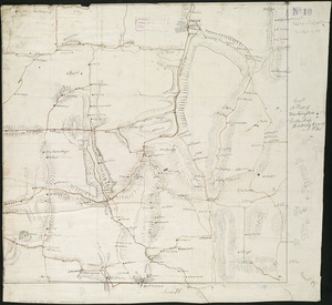
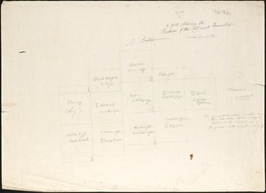
6627.
A plat showing the position of the different townships
6628.
Platte grond der stad Amsterdam
6629.
Plenty of free wi-fi is keeping Boston connected!
6630.
Plurime Sunt regiones que quidem singule singulis rebus excellere videntur
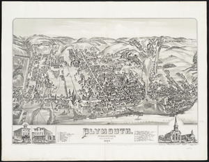
6631.
Plymouth : Pennsylvania
6632.
Plymouth : town of Plymouth
6633.
Plymouth, Grafton County, N.H : 1883
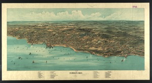
6634.
Plymouth, Mass : 1882
6635.
Plymouth, Mass
6636.
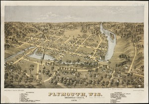
Plymouth, Wis : Sheboygan County, 1870
6637.
A pocket companion of Ireland : containing all the cities, market towns, boroughs, all ye great roads, and principal cross...
6638.
Pocket map of the city of Worcester, Mass : showing all streets, parks, distances, street car routes, location of public...
6639.
Pocket map showing the railroads, street railways, manufactories, deep water connections, blocks and subdivisions of the city...
6640.
Podrobnaia militernaia karta, po granits Rossii s Turtsieiu
‹ Prev
Next ›
1
2
…
328
329
330
331
332
333
334
335
336
…
435
436