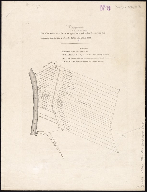
Plat of the ancient possessions of the upper prairie confirmed by the governors, their continuation from the Elm road to the Wabash and Indian Field
Item Information
- Title:
- Plat of the ancient possessions of the upper prairie confirmed by the governors, their continuation from the Elm road to the Wabash and Indian Field
- Creator:
- Vincennes (Ind.). Commissioner's Office
- Date:
-
[1806]
- Format:
-
Maps/Atlases
- Location:
-
Boston Public Library
Norman B. Leventhal Map & Education Center - Collection (local):
-
Norman B. Leventhal Map & Education Center Collection
- Subjects:
-
Real property--Indiana--Vincennes--Maps
Landowners--Indiana--Vincennes--Maps
Vincennes (Ind.)--Maps
- Places:
-
IndianaKnox (county)Vincennes
- Extent:
- 1 map ; 44 x 34 cm.
- Terms of Use:
-
No known copyright restrictions.
No known restrictions on use.
- Publisher:
-
Vincennes, Ind :
Commissioner's Office
- Scale:
-
Scale [ca. 1:5,500]
- Language:
-
English
- Notes:
-
Shows disputed property in northern Vincennes, Indiana.
Oriented with north to the upper left.
From "Land claims in the district of Vincennes, communicated to Congress, December 23, 1806," presented in 9th Congress, 2d session.
- Notes (date):
-
This date is inferred.
- Identifier:
-
06_01_011467
- Call #:
-
G4094.V5G46 1806 .V56
- Barcode:
-
39999065685479


