Toggle navigation
LMEC Home
Exhibitions
Georeferencing
Tools for Teachers
Collections
My Favorites
Sign Up / Log In
Search
Search the map portal
Map Collection
Map Collection
Map Sets
Search
Search
Search for
Search In
All Fields
Creator
Title
Subject
Place
Search All Digital Collections
Advanced Search
8769 Results
My Search
Start Over
More Like
commonwealth:cj82m2577
Remove constraint More Like: commonwealth:cj82m2577
Filter your Search
Place
North and Central America
5,997
United States
4,917
Massachusetts
2,083
Europe
1,396
Suffolk (county)
1,048
Boston
1,021
Canada
470
Asia
438
more
Place
»
Topic
Boston (Mass.)--Maps
588
United States--Maps
330
Real property--Massachusetts--Boston--Maps
175
Massachusetts--Maps
164
Landowners--Massachusetts--Boston--Maps
133
New England--Maps
127
North America--Maps--Early works to 1800
103
Europe--Maps
79
more
Topic
»
Date
Date range begin
–
Date range end
Current results range from
1482
to
2023
View distribution
Creator
United States. Hydrographic Office
595
O.H. Bailey & Co
148
Des Barres, Joseph F. W. (Joseph Frederick Wallet), 1722-1824
123
United States. Post Office Dept
120
Ptolemy, 2nd cent
100
Walling, Henry Francis, 1825-1888
94
Geological Survey (U.S.)
87
Jefferys, Thomas, -1771
86
more
Creator
»
Format
Maps/Atlases
8,709
Manuscripts
215
Prints
56
Books
36
Objects/Artifacts
10
Drawings/Illustrations
8
Posters
5
Georeferenced
Yes
873
No
7,896
Collection
Norman B. Leventhal Map & Education Center Collection
8,704
Boston and New England Maps
2,239
Urban Maps
2,023
Maritime Charts and Atlases
1,083
American Revolutionary War-Era Maps
674
Boston Redevelopment Authority Collection
87
Maps from AAS
29
William L. Clements Library Collection
16
more
Collection
»
Available to use
No known restrictions
8,560
Creative Commons license
53
Search Constraints
Sort by relevance
relevance
title
date (asc)
date (desc)
Number of results to display per page
20 per page
10
per page
20
per page
50
per page
100
per page
View results as:
grid view
map view
Search Results
5081.
Milwaukee County and Waukesha County, Wis.
5082.
Minerals
5083.
Minidoka Project, Idaho
5084.
Minnesota
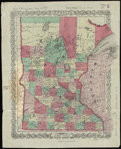
5085.
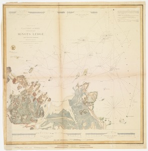
Minots Ledge off Boston Harbor : showing the proposed site of a light house
5086.
Miramichi Bay
5087.
Mississipi River, from Iberville to Yazous
5088.
[Mississippi River near Vicksburg and vicinity]
5089.
Mississippi Sound showing lines of soundings through Ship Island Pass, and from Ship Island Harbor to the main coast of...
5090.
Mississippi Territory and Georgia
5091.
Missouri-Illinois, Saint Louis special map
5092.
Mittel- und Nord-Africa, westl. theil
5093.
Mittel-America und Westindien
5094.
Mittineague, Mass
5095.
Mobile Bay, Alabama
5096.
The model war map giving the southern & middle states, with all their water & railroad connections
5097.
Modern Tibet (Hsi-K'Ang and Hsi-Tsang) - Political and Economic
5098.
Mogador-Taroudant
5099.
Mogg's strangers guide to London : exhibiting all the various alterations & improvements complete to the present time
5100.
Die Moldau
‹ Prev
Next ›
1
2
…
251
252
253
254
255
256
257
258
259
…
438
439


![[Mississippi River near Vicksburg and vicinity]](https://bpldcassets.blob.core.windows.net/derivatives/images/commonwealth:6w924q741/image_thumbnail_300.jpg)