Mississippi Sound showing lines of soundings through Ship Island Pass, and from Ship Island Harbor to the main coast of Mississippi
Item Information
- Title:
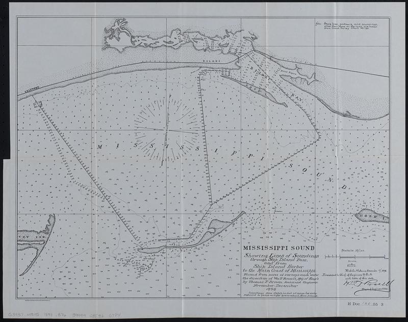
- Mississippi Sound showing lines of soundings through Ship Island Pass, and from Ship Island Harbor to the main coast of Mississippi
- Cartographer:
- Brown, Thomas P.
- Contributor:
- United States. Army. Corps of Engineers
- Contributor:
- United States. Congress. House. Report
- Name on Item:
-
plotted from notes of surveys made under the direction of Wm. T. Rossell, Maj. of engr's. by Thomas P. Brown, assistant engineer
- Date:
-
[1899]
- Format:
-
Maps/Atlases
- Genre:
-
Nautical charts
- Location:
-
Boston Public Library
Norman B. Leventhal Map & Education Center - Collection (local):
-
Norman B. Leventhal Map & Education Center Collection
- Subjects:
-
Mississippi Sound--Maps
Navigation--Mississippi Sound
- Places:
-
Mississippi Sound (bay)
- Extent:
- 1 map ; 38 x 50 cm
- Terms of Use:
-
No known copyright restrictions.
No known restrictions on use.
- Publisher:
-
[Washington] :
[Government Printing Office]
- Scale:
-
Scale 1:80,000
- Language:
-
English
- Notes:
-
Depths shown by soundings and isolines.
"Mobile Alabama, December 17th, 1898. Forwarded to Chief of Engineers U.S.A. with letter of this data. Wm. T. Rossell, Major of engineers, U.S.A."
In lower right: H Doc 120 55 3.
From Congressional serial set, 55th Congress, 3d session, House reports (Washington : Government Printing Office, 1899).
- Notes (date):
-
This date is inferred.
- Identifier:
-
06_01_018366
- Call #:
-
G3937.M5P5 1898 .B76
- Barcode:
-
39999085966784