Toggle navigation
LMEC Home
Exhibitions
Georeferencing
Tools for Teachers
Collections
My Favorites
Sign Up / Log In
Search
Search the map portal
Map Collection
Map Collection
Map Sets
Search
Search
Search for
Search In
All Fields
Creator
Title
Subject
Place
Search All Digital Collections
Advanced Search
8769 Results
My Search
Start Over
More Like
commonwealth:cj82m2577
Remove constraint More Like: commonwealth:cj82m2577
Filter your Search
Place
North and Central America
5,997
United States
4,917
Massachusetts
2,083
Europe
1,396
Suffolk (county)
1,048
Boston
1,021
Canada
470
Asia
438
more
Place
»
Topic
Boston (Mass.)--Maps
588
United States--Maps
330
Real property--Massachusetts--Boston--Maps
175
Massachusetts--Maps
164
Landowners--Massachusetts--Boston--Maps
133
New England--Maps
127
North America--Maps--Early works to 1800
103
Europe--Maps
79
more
Topic
»
Date
Date range begin
–
Date range end
Current results range from
1482
to
2023
View distribution
Creator
United States. Hydrographic Office
595
O.H. Bailey & Co
148
Des Barres, Joseph F. W. (Joseph Frederick Wallet), 1722-1824
123
United States. Post Office Dept
120
Ptolemy, 2nd cent
100
Walling, Henry Francis, 1825-1888
94
Geological Survey (U.S.)
87
Jefferys, Thomas, -1771
86
more
Creator
»
Format
Maps/Atlases
8,709
Manuscripts
215
Prints
56
Books
36
Objects/Artifacts
10
Drawings/Illustrations
8
Posters
5
Georeferenced
Yes
873
No
7,896
Collection
Norman B. Leventhal Map & Education Center Collection
8,704
Boston and New England Maps
2,239
Urban Maps
2,023
Maritime Charts and Atlases
1,083
American Revolutionary War-Era Maps
674
Boston Redevelopment Authority Collection
87
Maps from AAS
29
William L. Clements Library Collection
16
more
Collection
»
Available to use
No known restrictions
8,560
Creative Commons license
53
Search Constraints
Sort by relevance
relevance
title
date (asc)
date (desc)
Number of results to display per page
20 per page
10
per page
20
per page
50
per page
100
per page
View results as:
grid view
map view
Search Results
4801.
Map second division railway mail service
4802.
Map seventh division railway mail service
4803.
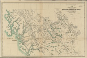
Map shewing exploratory surveys in the northern portion of the province of British Columbia
4804.
Map shewing the railways of Canada, to accompany annual report on railway statistics 1884
4805.
Map showing anchorage ground in the Port of New York and the Hudson and East Rivers
4806.
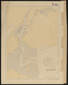
Map showing Boston territory tributary to South Metropolitan system and Boston main drainage system
4807.
Map showing branches of chartered banks in Manitoba, Saskatchewan and Alberta
4808.
Map showing branches of chartered banks in Ontario and Quebec
4809.
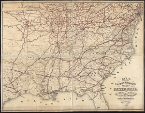
Map showing cotton growing region of the United States and means of transportation by water and rail
4810.
Map showing drives from the Walker-Gordon Laboratory, 203 Claredon St., Boston, to the Laboratory Farm in Wellesley
4811.
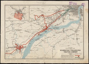
Map showing electric railway lines of the Wilmington and Philadelphia Traction Company
4812.
Map showing elevators in Manitoba, Saskatchewan and Alberta
4813.
Map showing horse rail roads and the surface steam roads with 104 stations in and around Boston : including 91 surface steam...
4814.
Map showing Japanese-Chinese warfre [sic] now in Shanghai
4815.
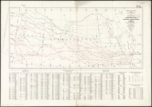
Map showing location of the Chicago & Northwestern Railway with its branches & connections through Illinois, Iowa, Nebraska,...
4816.
Map showing locations of temporary field works erected by the Spanish for the land defense of Havana, 1897-1898
4817.
Map showing long distance telephone lines and metallic circuit connections
4818.
Map showing Metropolitan Sewerage District : January 1, 1921
4819.
Map showing metropolitan sewerage district : January 1, 1910
4820.
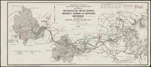
Map showing metropolitan water district, Wachusett, Sudbury and Cochituate watersheds and locations of reservoirs, aqueducts...
‹ Prev
Next ›
1
2
…
237
238
239
240
241
242
243
244
245
…
438
439


![Map showing Japanese-Chinese warfre [sic] now in Shanghai](https://bpldcassets.blob.core.windows.net/derivatives/images/commonwealth:9s161h819/image_thumbnail_300.jpg)