Toggle navigation
LMEC Home
Exhibitions
Georeferencing
Tools for Teachers
Collections
My Favorites
Sign Up / Log In
Search
Search the map portal
Map Collection
Map Collection
Map Sets
Search
Search
Search for
Search In
All Fields
Creator
Title
Subject
Place
Search All Digital Collections
Advanced Search
8726 Results
My Search
Start Over
More Like
commonwealth:cj82m1988
Remove constraint More Like: commonwealth:cj82m1988
Filter your Search
Place
North and Central America
5,957
United States
4,875
Massachusetts
2,088
Europe
1,396
Suffolk (county)
1,074
Boston
1,047
Canada
449
Asia
438
more
Place
»
Topic
Boston (Mass.)--Maps
586
United States--Maps
282
Real property--Massachusetts--Boston--Maps
175
Massachusetts--Maps
162
Landowners--Massachusetts--Boston--Maps
133
North America--Maps--Early works to 1800
103
New England--Maps
102
Europe--Maps
79
more
Topic
»
Date
Date range begin
–
Date range end
Current results range from
1482
to
2023
View distribution
Creator
United States. Hydrographic Office
595
O.H. Bailey & Co
148
Des Barres, Joseph F. W. (Joseph Frederick Wallet), 1722-1824
123
United States. Post Office Dept
120
Ptolemy, 2nd cent
100
Walling, Henry Francis, 1825-1888
94
Geological Survey (U.S.)
86
Jefferys, Thomas, -1771
85
more
Creator
»
Format
Maps/Atlases
8,664
Manuscripts
227
Prints
56
Books
36
Drawings/Illustrations
10
Objects/Artifacts
10
Posters
5
Georeferenced
Yes
874
No
7,852
Collection
Norman B. Leventhal Map & Education Center Collection
8,704
Boston and New England Maps
2,242
Urban Maps
2,027
Maritime Charts and Atlases
1,083
American Revolutionary War-Era Maps
646
Boston Redevelopment Authority Collection
87
Mapping Boston Collection
10
Richard H. Brown Revolutionary War Map Collection at Mount Vernon
10
more
Collection
»
Available to use
No known restrictions
8,554
Creative Commons license
76
Search Constraints
Sort by relevance
relevance
title
date (asc)
date (desc)
Number of results to display per page
20 per page
10
per page
20
per page
50
per page
100
per page
View results as:
grid view
map view
Search Results
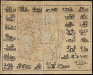
4421.
Map of the town of Woodbury, Litchfield County, Connecticut
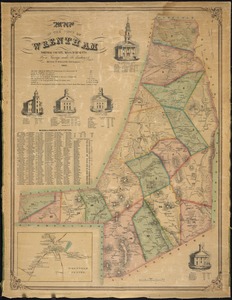
4422.
Map of the town of Wrentham : Norfolk County, Massachusetts
4423.
A map of the towns of Dorchester and Milton, 1831
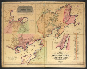
4424.
Map of the towns of Gloucester and Rockport, Essex Co., Massachusetts
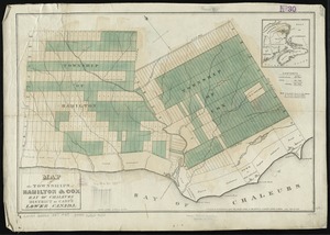
4425.
Map of the townships of Hamilton & Cox, Bay of Chaleurs, District of Caspé, Lower Canada
4426.
Map of the Troy & Greenfield Rail Road and its connections
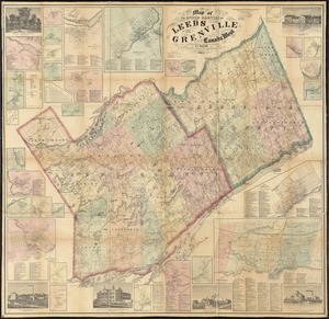
4427.
Map of the United Counties of Leeds and Grenville, Canada West
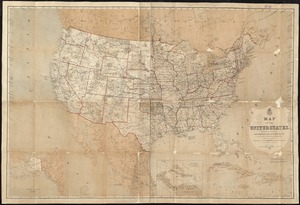
4428.
Map of the United States
4429.
Map of the United States : intending chiefly to exhibit the post roads & distances
4430.
Map of the United States
4431.
Map of the United States
4432.
Map of the United States
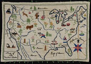
4433.
A map of the United States
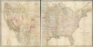
4434.
A map of the United States : compiled chiefly from the state maps, and other authentic information
4435.
Map of the United States
4436.
Map of the United States
4437.
A map of the United States and Canada, New-Scotland, New-Brunswick and New-Foundland = Carte des Etats-Unis avec le Canada, la...
4438.
Map of the United States and territories, showing the extent of public surveys and other details
4439.
Map of the United States and territories, showing the extent of public surveys and other details constructed from the plats and...
4440.
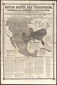
Map of the United States and territories, showing the possessions and aggressions of the slave power
‹ Prev
Next ›
1
2
…
218
219
220
221
222
223
224
225
226
…
436
437