Toggle navigation
LMEC Home
Exhibitions
Georeferencing
Tools for Teachers
Collections
My Favorites
Sign Up / Log In
Search
Search the map portal
Map Collection
Map Collection
Map Sets
Search
Search
Search for
Search In
All Fields
Creator
Title
Subject
Place
Search All Digital Collections
Advanced Search
8726 Results
My Search
Start Over
More Like
commonwealth:cj82m1988
Remove constraint More Like: commonwealth:cj82m1988
Filter your Search
Place
North and Central America
5,957
United States
4,875
Massachusetts
2,088
Europe
1,396
Suffolk (county)
1,074
Boston
1,047
Canada
449
Asia
438
more
Place
»
Topic
Boston (Mass.)--Maps
586
United States--Maps
282
Real property--Massachusetts--Boston--Maps
175
Massachusetts--Maps
162
Landowners--Massachusetts--Boston--Maps
133
North America--Maps--Early works to 1800
103
New England--Maps
102
Europe--Maps
79
more
Topic
»
Date
Date range begin
–
Date range end
Current results range from
1482
to
2023
View distribution
Creator
United States. Hydrographic Office
595
O.H. Bailey & Co
148
Des Barres, Joseph F. W. (Joseph Frederick Wallet), 1722-1824
123
United States. Post Office Dept
120
Ptolemy, 2nd cent
100
Walling, Henry Francis, 1825-1888
94
Geological Survey (U.S.)
86
Jefferys, Thomas, -1771
85
more
Creator
»
Format
Maps/Atlases
8,664
Manuscripts
227
Prints
56
Books
36
Drawings/Illustrations
10
Objects/Artifacts
10
Posters
5
Georeferenced
Yes
874
No
7,852
Collection
Norman B. Leventhal Map & Education Center Collection
8,704
Boston and New England Maps
2,242
Urban Maps
2,027
Maritime Charts and Atlases
1,083
American Revolutionary War-Era Maps
646
Boston Redevelopment Authority Collection
87
Mapping Boston Collection
10
Richard H. Brown Revolutionary War Map Collection at Mount Vernon
10
more
Collection
»
Available to use
No known restrictions
8,554
Creative Commons license
76
Search Constraints
Sort by relevance
relevance
title
date (asc)
date (desc)
Number of results to display per page
20 per page
10
per page
20
per page
50
per page
100
per page
View results as:
grid view
map view
Search Results
3501.
Map of Burma : prepared for the Ireland report on colonial administration in the Far East
3502.
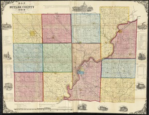
Map of Butler County, Ohio
3503.
Map of Caledonia County, Vermont
3504.
Map of Calhoun County, Michigan
3505.
Map of California and Nevada
3506.
Map of California and Nevada
3507.
Map of California and Nevada, with parts of Utah & Arizona
3508.
Map of California Pacific Railroad : showing its relative position to other railroads
3509.
Map of Cambria Co., Penna
3510.
Map of Cambridge
3511.
Map of Cambridge in the vicinity of Harvard College 1903-4
3512.
A map of Cambridge, Mass
3513.
Map of Cambridge Massachusetts
3514.
Map of Cambridge roads, about 1807
3515.
A map of Canaan : with the adjacent countrie's very usefull for the understanding of the Old Testament
3516.
A map of Canaan, Palestine, Judea, or the Holy Land : as divided among the 12 tribes
3517.
A map of Canada
3518.
A map of Canada and the north part of Louisiana with the adjacent countrys
3519.
A map of Canada and the north part of Louisiana with the adjacent countrys
3520.
A map of Cape Cod
‹ Prev
Next ›
1
2
…
172
173
174
175
176
177
178
179
180
…
436
437