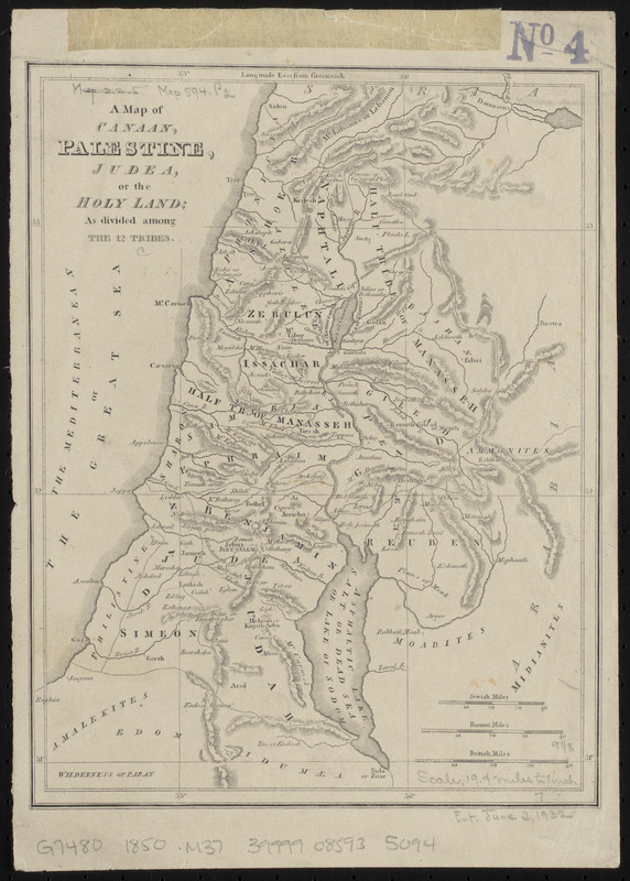
A map of Canaan, Palestine, Judea, or the Holy Land : as divided among the 12 tribes
Item Information
- Title:
- A map of Canaan, Palestine, Judea, or the Holy Land : as divided among the 12 tribes
- Date:
-
[ca. 1850–1859]
- Format:
-
Maps/Atlases
- Location:
-
Boston Public Library
Norman B. Leventhal Map & Education Center - Collection (local):
-
Norman B. Leventhal Map & Education Center Collection
- Subjects:
-
Geography--Maps
Twelve tribes of Israel--Maps
Palestine--Maps
- Places:
-
Palestine (area)
- Extent:
- 1 map ; 24 x 18 cm
- Terms of Use:
-
No known copyright restrictions.
No known restrictions on use.
- Publisher:
-
[Place of publication not identified] :
[publisher not identified]
- Scale:
-
Scale approximately 1:1,280,000
- Language:
-
English
- Notes:
-
Relief show by hachures.
- Identifier:
-
06_01_015322
- Call #:
-
G7480 1850 .M37
- Barcode:
-
39999085935094