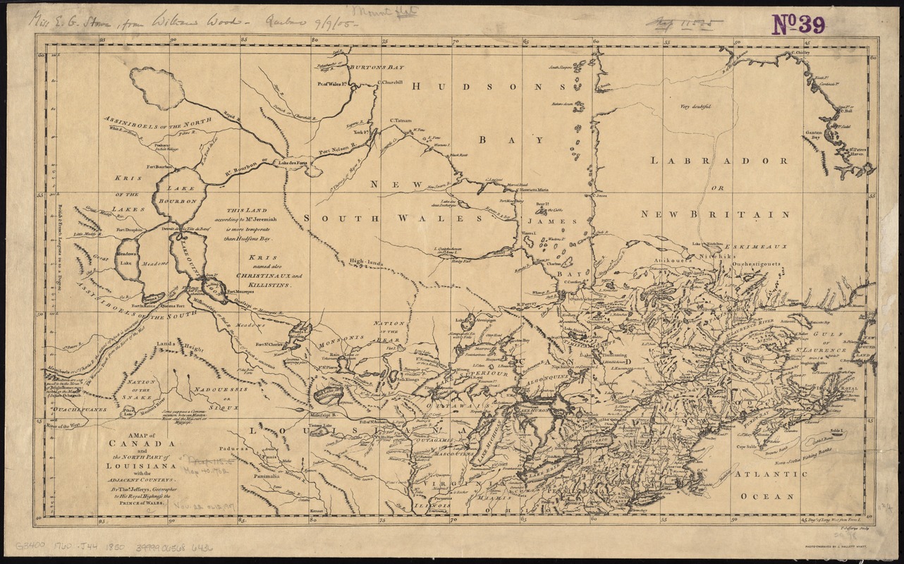
A map of Canada and the north part of Louisiana with the adjacent countrys
Item Information
- Title:
- A map of Canada and the north part of Louisiana with the adjacent countrys
- Creator:
- Jefferys, Thomas, -1771
- Name on Item:
-
by Thos. Jefferys, geographer to His Royal Highness the Prince of Wales ; T. Jefferys sculp.
- Date:
-
[1850?–1859?]
- Format:
-
Maps/Atlases
- Location:
-
Boston Public Library
Norman B. Leventhal Map & Education Center - Collection (local):
-
Norman B. Leventhal Map & Education Center Collection
- Subjects:
-
Canada--Maps--Early works to 1800--Facsimiles
United States--Maps--Early works to 1800--Facsimiles
- Places:
-
United States
Canada
- Extent:
- 1 map ; 30 x 54 cm.
- Terms of Use:
-
No known copyright restrictions.
No known restrictions on use.
- Publisher:
-
[S.l.] :
J. Hallett Hyatt
- Scale:
-
Scale [ca. 1:6,300,000]
- Language:
-
English
- Notes:
-
Facsimile of the earlier version, not extended to the Pacific Ocean.
Relief shown pictorially.
Prime meridian: Ferro I.
"Photo-engraved by J. Hallett Hyatt."
Original published in Jeffery's The natural and civil history of the French dominions in North and South America, 1760.
- Identifier:
-
06_01_011557
- Call #:
-
G3400 1760 .J44 1850
- Barcode:
-
39999065686436