Toggle navigation
LMEC Home
Exhibitions
Georeferencing
Tools for Teachers
Collections
My Favorites
Sign Up / Log In
Search
Search the map portal
Map Collection
Map Collection
Map Sets
Search
Search
Search for
Search In
All Fields
Creator
Title
Subject
Place
Search All Digital Collections
Advanced Search
8766 Results
My Search
Start Over
More Like
commonwealth:cj82kv515
Remove constraint More Like: commonwealth:cj82kv515
Filter your Search
Place
North and Central America
5,997
United States
4,912
Massachusetts
2,081
Europe
1,396
Suffolk (county)
1,046
Boston
1,019
Canada
455
Asia
438
more
Place
»
Topic
Boston (Mass.)--Maps
586
United States--Maps
282
Real property--Massachusetts--Boston--Maps
175
Massachusetts--Maps
164
Landowners--Massachusetts--Boston--Maps
133
New England--Maps
110
North America--Maps--Early works to 1800
103
New York (State)--Maps
85
more
Topic
»
Date
Date range begin
–
Date range end
Current results range from
1482
to
2023
View distribution
Creator
United States. Hydrographic Office
595
O.H. Bailey & Co
148
Des Barres, Joseph F. W. (Joseph Frederick Wallet), 1722-1824
123
United States. Post Office Dept
120
Ptolemy, 2nd cent
100
Walling, Henry Francis, 1825-1888
94
Geological Survey (U.S.)
86
Jefferys, Thomas, -1771
86
more
Creator
»
Format
Maps/Atlases
8,706
Manuscripts
218
Prints
56
Books
36
Objects/Artifacts
10
Drawings/Illustrations
8
Posters
5
Georeferenced
Yes
871
No
7,895
Collection
Norman B. Leventhal Map & Education Center Collection
8,695
Boston and New England Maps
2,233
Urban Maps
2,023
Maritime Charts and Atlases
1,083
American Revolutionary War-Era Maps
688
Boston Redevelopment Authority Collection
87
William L. Clements Library Collection
50
Maps from AAS
11
more
Collection
»
Available to use
No known restrictions
8,554
Creative Commons license
49
Search Constraints
Sort by relevance
relevance
title
date (asc)
date (desc)
Number of results to display per page
20 per page
10
per page
20
per page
50
per page
100
per page
View results as:
grid view
map view
Search Results
81.
Rail road map of New England & eastern New York
82.
Rand McNally official 1920 auto trails map : District number 6 : New England, eastern New York
83.
Road map of the Albany-Troy district
84.
Scarborough's new railroad, post office, township and county map of New York with distances between stations
85.
Sherman & Smith's rail road, steam boat & stage route map of New England, New-York, and Canada
86.
State of New York
87.
The state of New York
88.
The state of New York, compiled from the best authorities
89.
The state of New York with part of the adjacent states
90.
The tourist's map of the state of New York : compiled from the latest authorities in the Surveyor General's office
91.
Transportation map of New York
92.
Williams' telegraph and rail road map of the New England states, eastern protion of New York state and Canada : compiled from...
93.
Bridge from Staten Island to the Jersies, by Cn. Laird's description
94.
Carte du theatre de la guerre presente en Amerique
95.
From Freehold toward Trenton
96.
Map of American camp in New Jersey and surrounding countryside
97.
A new and accurate map of New Jersey, from the best authorities
98.
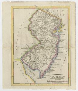
New Jersey
99.
Northern New Jersey
100.
A plan of the northern part of New Jersey : shewing the positions of the American and British armies after crossing the North...
‹ Prev
Next ›
1
2
3
4
5
6
7
8
9
…
438
439