Toggle navigation
LMEC Home
Exhibitions
Georeferencing
Tools for Teachers
Collections
My Favorites
Sign Up / Log In
Search
Search the map portal
Map Collection
Map Collection
Map Sets
Search
Search
Search for
Search In
All Fields
Creator
Title
Subject
Place
Search All Digital Collections
Advanced Search
8802 Results
My Search
Start Over
More Like
commonwealth:cj82kt994
Remove constraint More Like: commonwealth:cj82kt994
Filter your Search
Place
North and Central America
6,033
United States
4,930
Massachusetts
2,152
Europe
1,396
Suffolk (county)
1,049
Boston
1,022
Canada
456
Asia
438
more
Place
»
Topic
Boston (Mass.)--Maps
592
United States--Maps
282
Massachusetts--Maps
235
Real property--Massachusetts--Boston--Maps
175
Landowners--Massachusetts--Boston--Maps
133
New England--Maps
127
North America--Maps--Early works to 1800
103
Europe--Maps
79
more
Topic
»
Date
Date range begin
–
Date range end
Current results range from
1482
to
2023
View distribution
Creator
United States. Hydrographic Office
595
O.H. Bailey & Co
148
Des Barres, Joseph F. W. (Joseph Frederick Wallet), 1722-1824
123
United States. Post Office Dept
120
Ptolemy, 2nd cent
100
Walling, Henry Francis, 1825-1888
95
Geological Survey (U.S.)
93
Jefferys, Thomas, -1771
86
more
Creator
»
Format
Maps/Atlases
8,741
Manuscripts
217
Prints
56
Books
36
Objects/Artifacts
10
Drawings/Illustrations
8
Posters
5
Ephemera
1
Georeferenced
Yes
882
No
7,920
Collection
Norman B. Leventhal Map & Education Center Collection
8,742
Boston and New England Maps
2,286
Urban Maps
2,024
Maritime Charts and Atlases
1,083
American Revolutionary War-Era Maps
660
Boston Redevelopment Authority Collection
90
David Judkins Weaver Papers
23
Applied Geographics, Inc. Records
20
more
Collection
»
Available to use
No known restrictions
8,600
Creative Commons license
54
Search Constraints
Sort by relevance
relevance
title
date (asc)
date (desc)
Number of results to display per page
20 per page
10
per page
20
per page
50
per page
100
per page
View results as:
grid view
map view
Search Results
4101.
Map of Texas and parts of adjoining territories
4102.
Map of Texas and the country adjacent
4103.
Map of that part of Hannover where the late battle between the Duke of Cumberland and Marshal D'Etrees was fought July 25, 26, 27
4104.
Map of that part of the mineral lands adjacent to Lake Superior, ceded to the United States by the treaty of 1842 with the...
4105.
Map of that portion of the Department of the Platte and adjacent territory west of the 103rd meridian
4106.
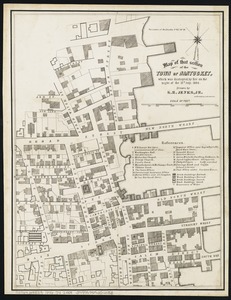
Map of that section of the town of Nantucket, which was destroyed by the fire on the night of the 13th July, 1846
4107.
Map of the Adirondack Forest and adjoining territory
4108.
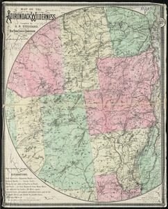
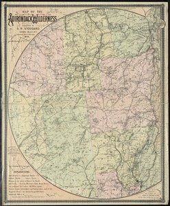
Map of the Adirondack wilderness
4109.
Map of the Adirondack wilderness
4110.
Map of the Adirondacks, as reached by the Delaware and Hudson Canal Companys Railroad ; Map of Lake George
4111.
Map of the alluvial valley of the Mississippi River from the head of St. Francis Basin to the Gulf of Mexico, showing lands...
4112.
Map of the Alton & Springfield railroad, in Illinois : showing its connection with other roads and proposed roads leading to...
4113.
Map of the Antarctic
4114.
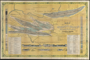
Map of the anthracite coalfields of Pennsylvania
4115.
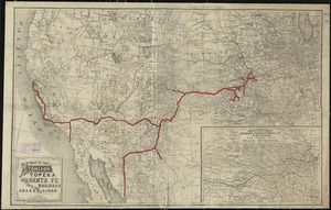
Map of the Atchison Topeka and Santa Fe Railroad and its leased lines
4116.
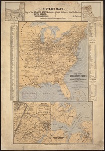
Map of the Atlantic States, showing distances from Washington (in bee line) by 50 mile circles
4117.
Map of the Back Bay Fens showing the public ways bordering and crossing them and the neighboring newly laid out parts of...
4118.
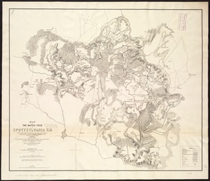
Map of the battle field of Spottsylvania C.H : showing the field of operations of the Army of the Potomac commanded by Maj....
4119.
Map of the battle fields of North Anna : showing the field of operations of the Army of the Potomac commanded by Maj. Gen....
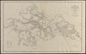
4120.
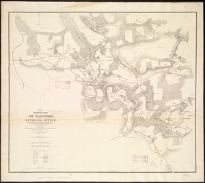
Map of the battle fields of the Tolopotomoy, and Bethesda Church : showing the field of operations of the Army of the Potomac...
‹ Prev
Next ›
1
2
…
202
203
204
205
206
207
208
209
210
…
440
441