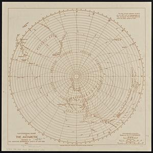
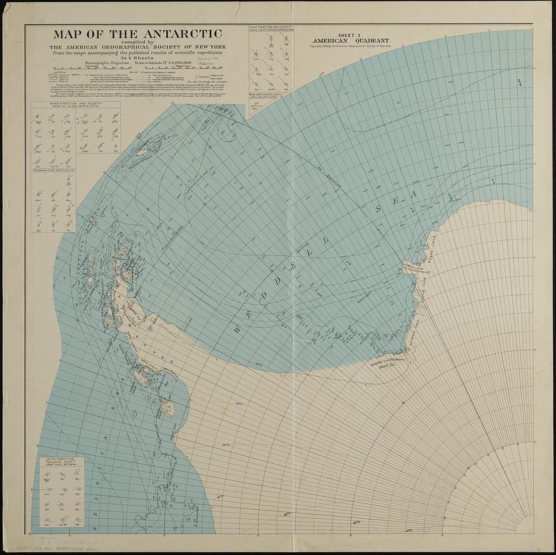
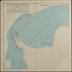
Map of the Antarctic
Item Information
- Title:
- Map of the Antarctic
- Publisher:
- American Geographical Society of New York
- Name on Item:
-
compiled by the American Geographical Society of New York from the maps accompanying the published results of scientific expeditions
- Date:
-
1928
- Format:
-
Maps/Atlases
- Location:
-
Boston Public Library
Norman B. Leventhal Map & Education Center - Collection (local):
-
Norman B. Leventhal Map & Education Center Collection
- Subjects:
-
Antarctica--Maps
- Places:
-
Antarctica
- Extent:
- 1 map on 4 sheets : col. ; sheets 81 x 81 cm. + explanatory note (8 p. ; 16 cm.)
- Terms of Use:
-
No known copyright restrictions.
No known restrictions on use.
- Publisher:
-
New York :
The Society
- Scale:
-
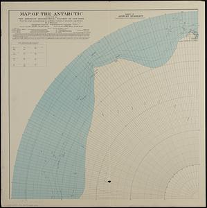
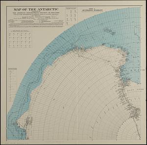
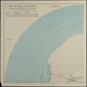
Scale 1:4,000,000
- Language:
-
English
- Table of Contents:
-
Sheet 1: America quadrant
sheet 2: African quadrant
sheet 3: Australian quadrant
sheet 4: Pacific quadrant.
- Notes:
-
Relief shown by contours and spot heights. Depth shown by soundings and isolines.
Wind direction and velocity shown for each quadrant.
- Identifier:
-
06_01_018935A
06_01_018935B
06_01_018935C
06_01_018935D
- Call #:
-
G9800 1928 .A44
- Barcode:
-
39999065686766